 The Kožbanšček Brook
(47 pictures)
The Kožbanšček Brook
(47 pictures)
1953, 1 picture, 2003, 10 pictures, 2006, 4 pictures, 2010, 5 pictures, 2015, 3 pictures,
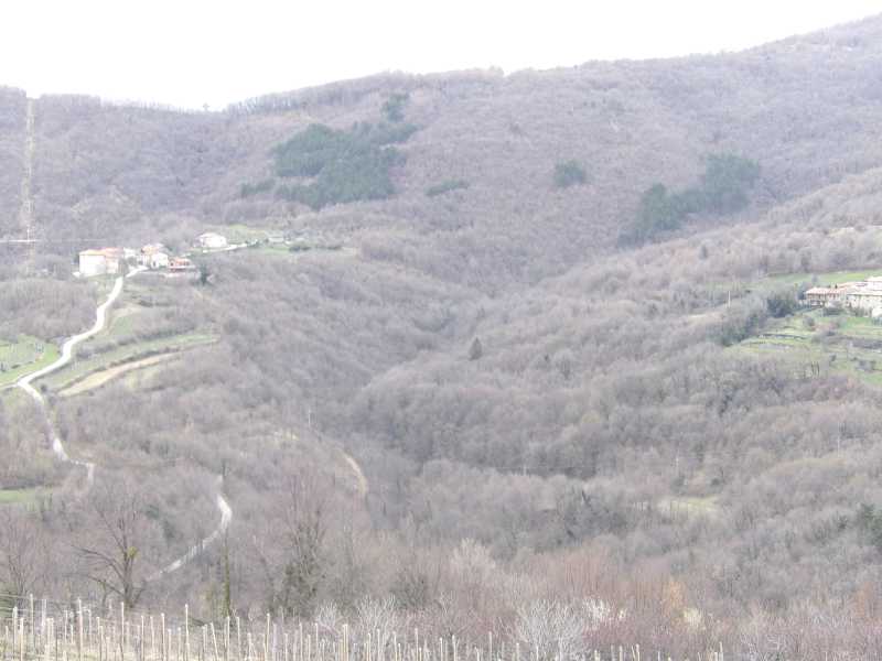
The Kožbanšček brook flows into the Soča river through the Reka brook and
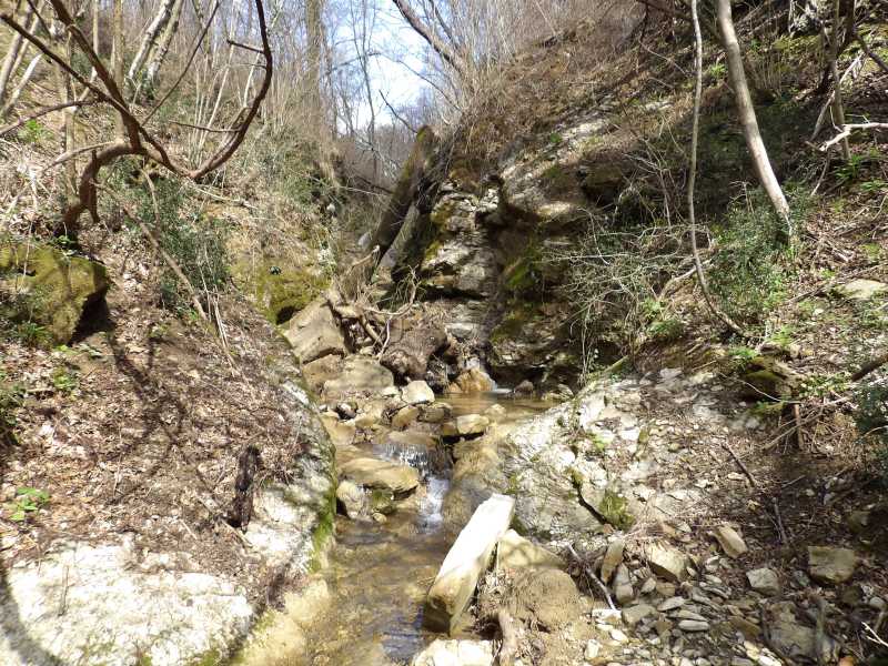
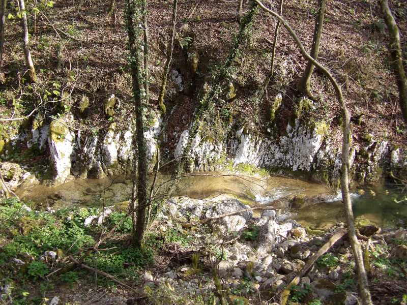
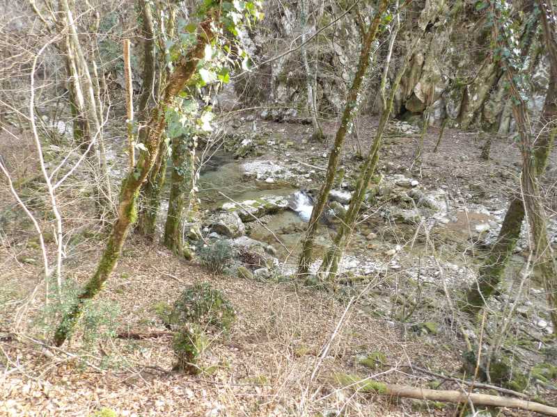
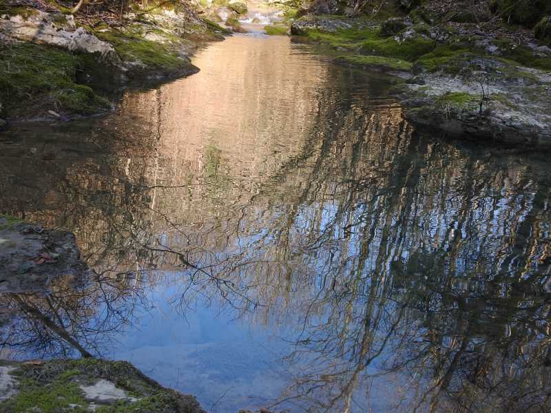
The View of the Right Branch of the Spring Area
The Brdce on right side of picture and the Brezovk villages on the other side of the branch.
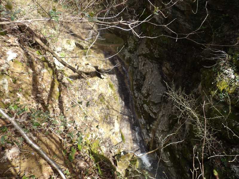
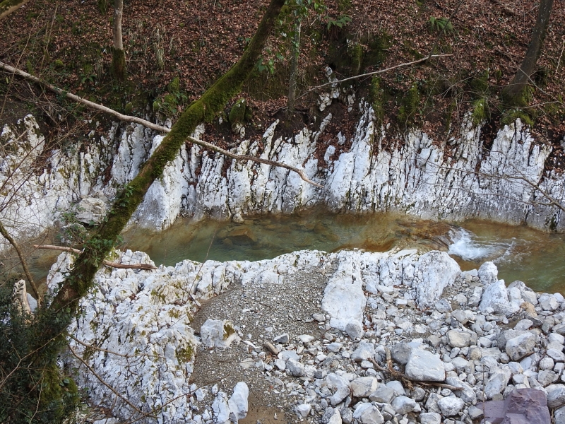
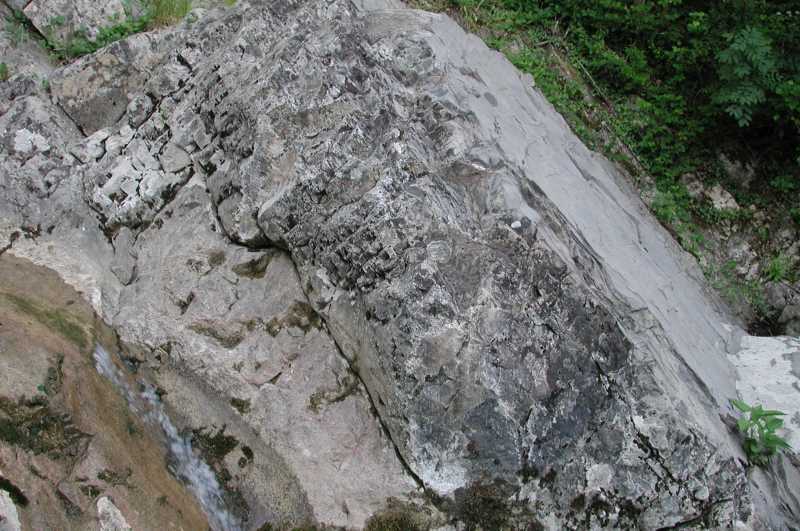
The Upper Part of the Evorsion Channel Gorge in Hard Marl
The brook stands out from a naturalistic point of view with these evorsion channel gorge in marl,
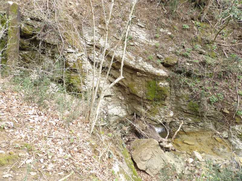
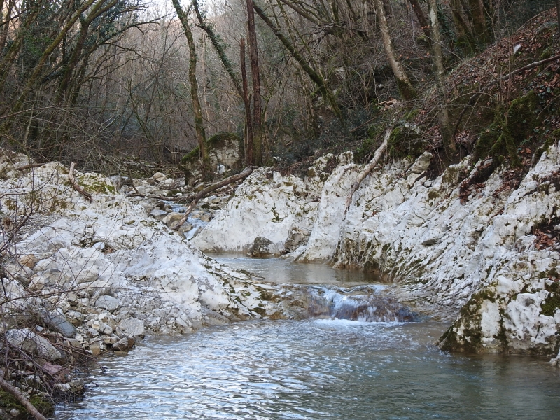
The Lower Part of the Evorsion Channel Gorge in Hard Marl
The marl was formed in the Middle Paleocene (Sealandian) as a part of flysch around 61.6 to 59.2 million years ago.
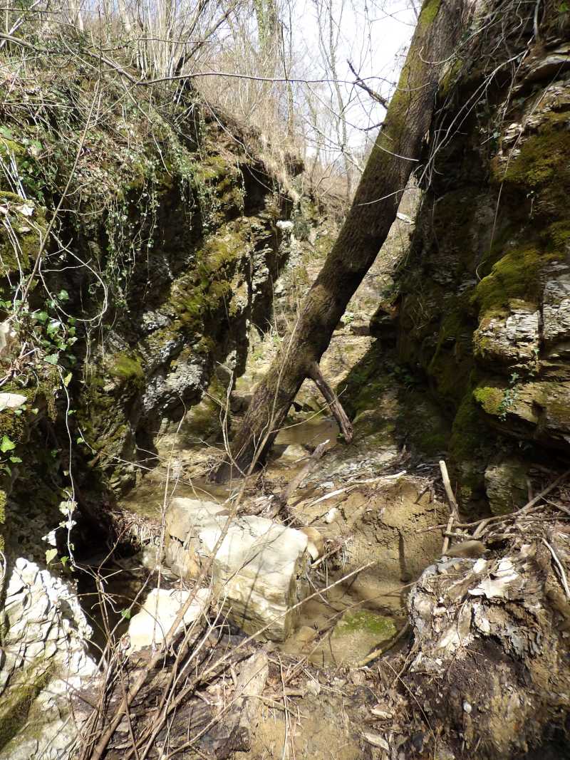
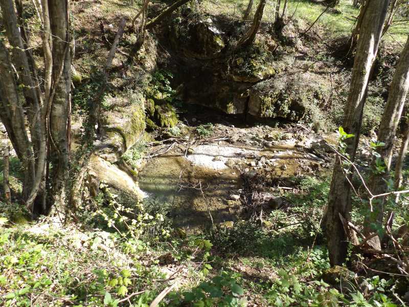
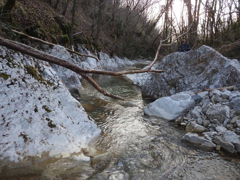
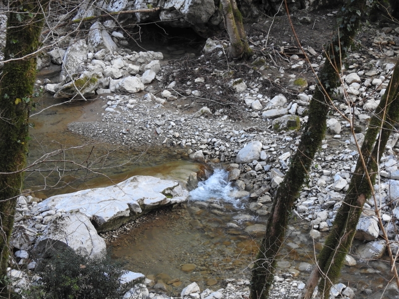
The Evorsion Channel Gorge in Hard Marl Before the Outlet Mouth
3rd April, 2018.
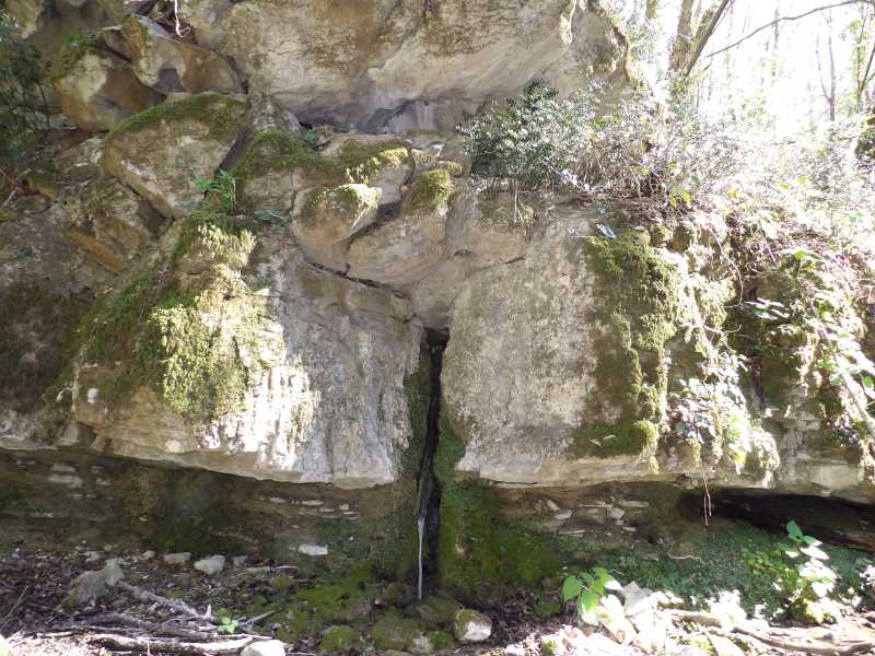
The Outlet Mouth of the Evorsion Channel Gorge in Hard Marl
3rd April, 2018.
The Middle Waterfall Step in the Evorsion Channel Gorge in Hard Marl
A three-step waterfall is about 9 m high and falls in the channel.
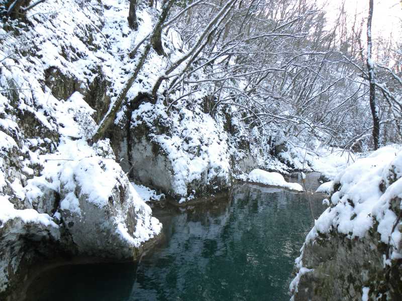
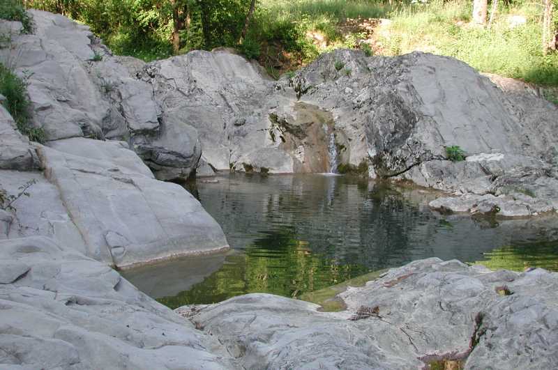
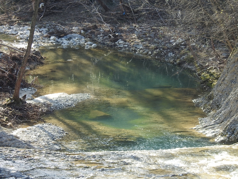
A Pool Near the Kužini Homestead
Near the end of the left spring branch water formed
a pool with steep and precipitous walls.
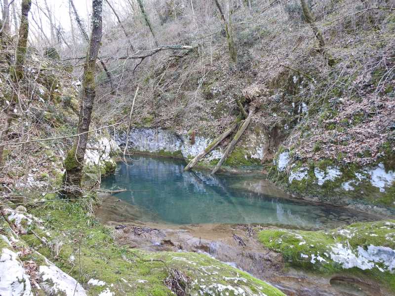
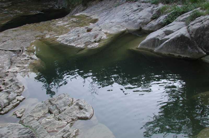
The Strujnca Small Karst Spring
5th April, 2015.
2017, 1 picture, 2018, 7 pictures, 2021, 4 pictures, 2023, 2 pictures, 2026, 10 pictures,
all of them are 800 x 600 pixels in size.
Page, texts and photos all rights to them © Daniel Rojšek, Danč, 2003-2026,
except -
- the Old Picture of Krčnik taken by Milko Matičetov and
copyrighted © by
Slovenski etnografski muzej and
- two pictures of Matevž taken by
Mikhail Tertychnyi, Misha.
He owns all rights to them ©.
the Idrija and Ter rivers.
Our brook springs in two branches -
- the left one with two tributaries near the Slapnik village and
- the right one between the Brdce and the Brezovk villages.
3rd April, 2018.
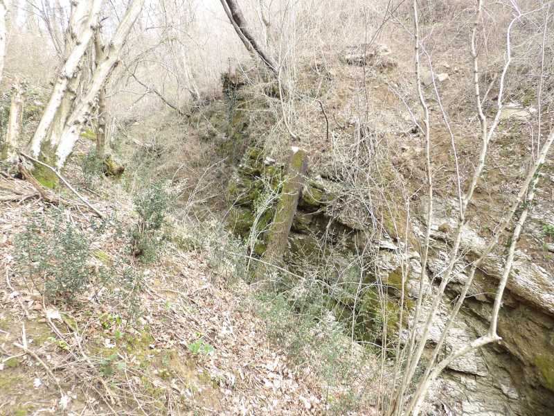
the only ones known up to date in this rock in Slovenia.
The evorsion channel gorge are about 40 m long, up to 10 m wide and up to 15 m deep.
During droughts, the flow is very modest.
3rd April, 2018.
3rd April, 2018.
3rd April, 2018.
Water falls into it with a picturesque small travertine waterfall.
There is a crack in the left wall before its end, where a small karst spring called Strujnca flows.
5th April, 2015.
The Mala korita - Evorsion Channel, the 1st Picture
An extremely high flood on the night between Sunday, 16th and Monday, 17th November 2025,
revealed small evorsion channel approximately 250 m before the Krčnik.
This is how we see them from the road, they are about 20 m long, up to 5 m wide, the right wall is only up to 2 m high,
1st February 2026.
The Mala korita - Evorsion Channel, the 2nd Picture
Inflow mouth,
1st February 2026.
The Mala korita - Evorsion Channel, the 3rd Picture
Outflow mouth,
1st February 2026.
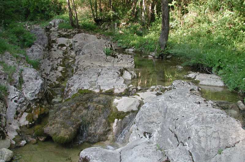
The Rocky Bed of the Kožbanšček Brook Below the Proj Homestead
5th April, 2015.
The Rock Barrier in the Bed of the Kožbanšček Brook Before the Krčnik,
the 1st Picture
12th February, 2017.
The Rock Barrier in the Bed of the Kožbanšček Brook Before the Krčnik,
the 2nd Picture
The November flood of the year 2025 carved an interesting hole in the left bank,
1st February 2026.
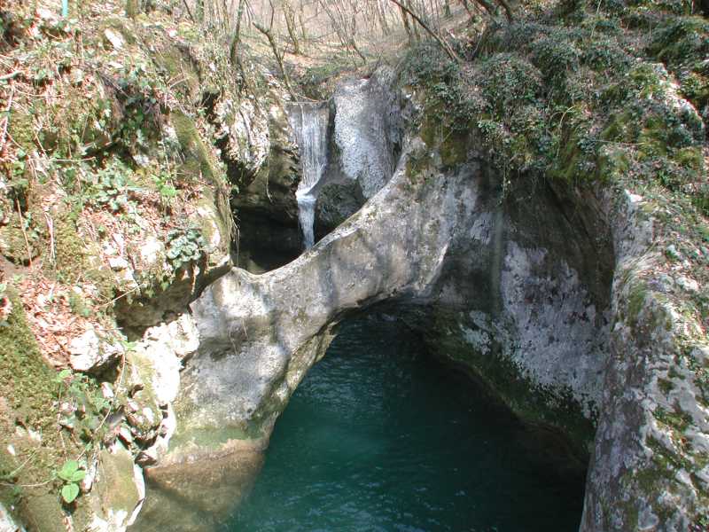
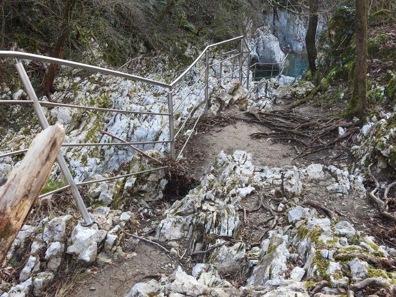
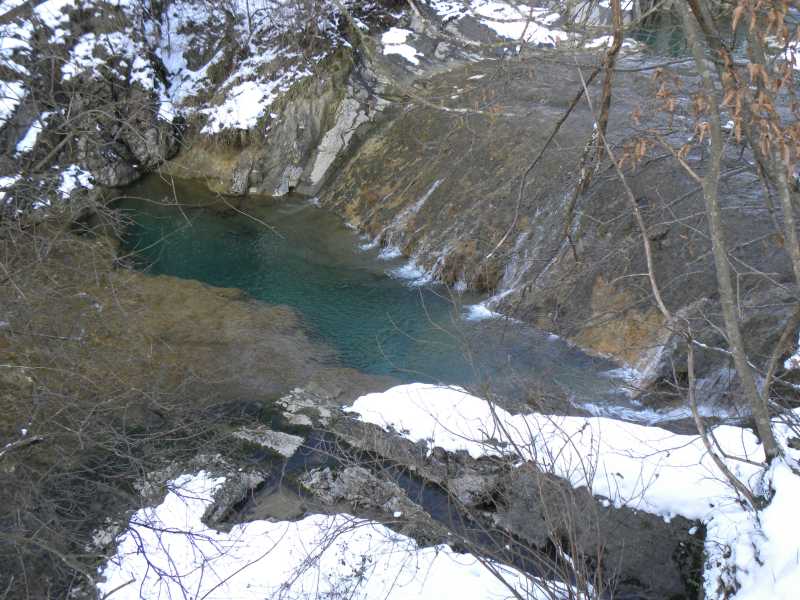
The Krčnik
View of the natural bridge and the Korita - Evorsion Channel Gorge, with the flow,
2nd April, 2006.
The Old Picture of Krčnik
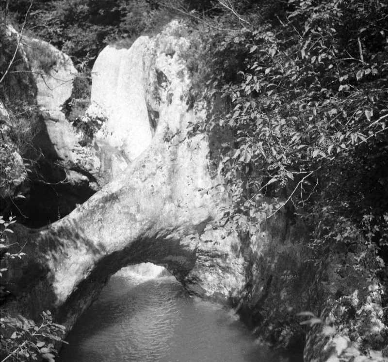
The same view as in the next picture, without the barrier, which was erected shortly after the photo was taken.
31st July, 1953.
Source
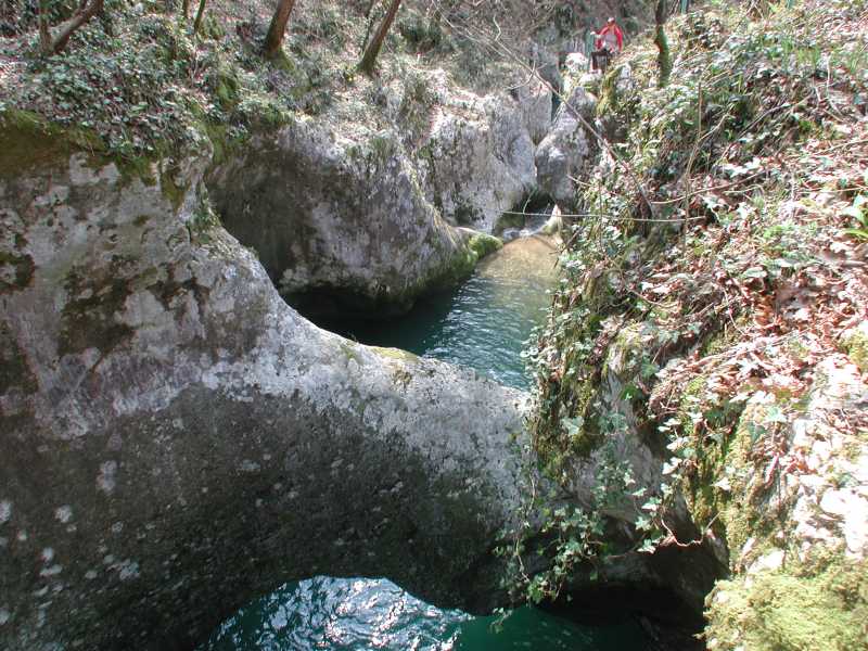
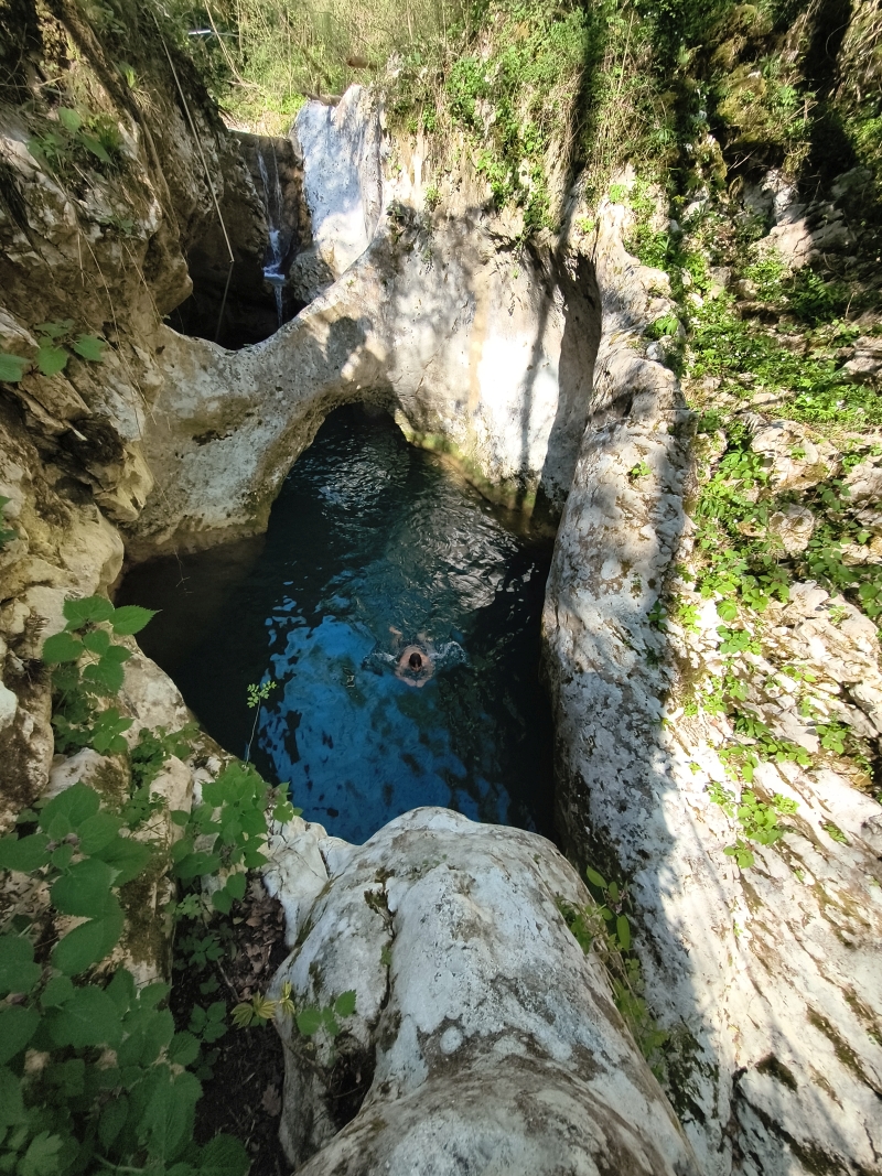
The Krčnik
View of the pool, natural bridge and waterfall, against the flow,
2nd April, 2006.
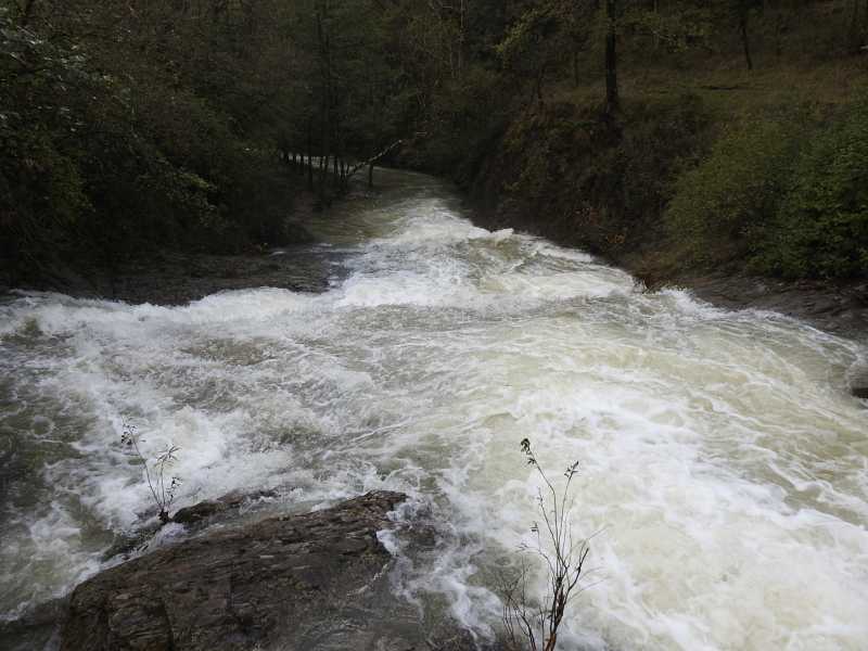
The Krčnik at High Water
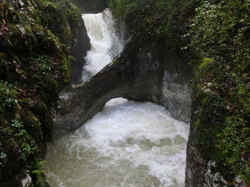
At a the Neblo automatic hydrological station a discharge
was 5.66 cubic meters per second at the time of taking picture,
5th November, 2023.
The Krčnik

View of the pool at the outflow mouth, with the flow,
2nd April, 2006.
The Krčnik

Liverleaf (Hepatica nobilis), wild garlic (Allium ursinum) and
maidenhair spleenwort (Asplenium trichomanes),
2nd April, 2006.
The Krčnik
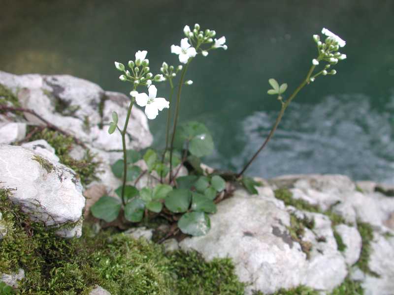
Three-Leaved Bittercress (Cardamine trifolia),
2nd April, 2006.
The Krčnik
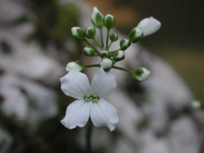
Close view of buds and blossom of Three-Leaved Bittercress (Cardamine trifolia),
2nd April, 2006.
The Krčnik

A rare winter scene in the embrace of snow, the first image,
Normally, the snowdrop (Galanthus nivalis)
already preparing to flowering in mid-December in the area.
18th December, 2010.
The Krčnik
The second winter scene,
18th December, 2010.
The Krčnik

The third winter scene,
18th December, 2010.
The Outlet Mouth of the Krčnik
In the mouth travertine grows faster than erosion takes it away.
This is an exceptional natural phenomenon, as it is the only travertine at the bottom of an evorsion channel known in Slovenia.
24th February, 2021.
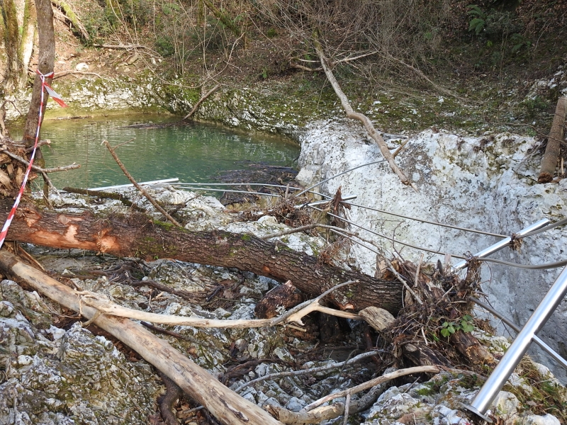
View of the Krčnik from Above
Remnants of the extremely high flood during the night
between Sunday, 16th and Monday, 17th November 2025,
1st February 2026.
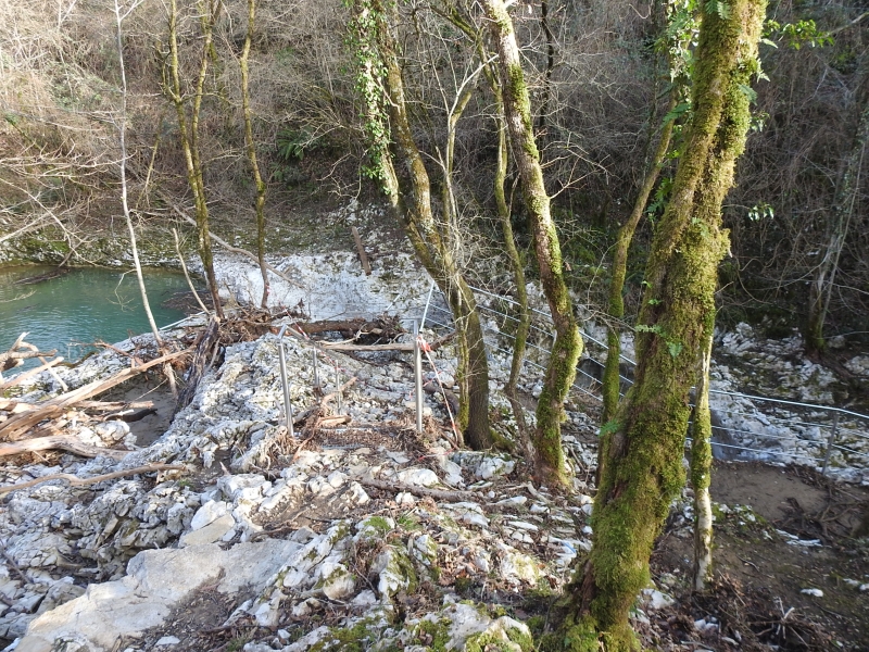
Damaged Fence above the Inflow Mouth
1st February 2026.
Washed Walls
1st February 2026.
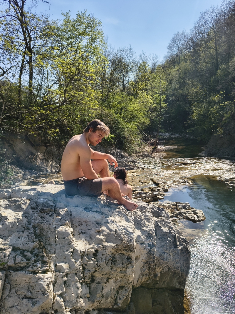
Matevž Swimmer
Matevž Marinko heroically jumped over the natural bridge into the water and swam to the end of the Krčnik.
The water temperature was below 10 degrees Celsius,
5th April 2026.
This picture was taken by
Mikhail Tertychnyi, Misha.
He owns all rights to it ©.
Misha also swam in the Krčnik.
The First Picture of the Brookbed Beetwen the Krčnik and the Kotline
The brookbed is carved into the bedrock, is free of gravel, overgrown with moss, and covered with
travertine, where water flows constantly. All this creates picturesque scenes.
14th February, 2021.
The Second Picture of the Brookbed Beetwen the Krčnik and the Kotline
14th February, 2021.
The Third Picture of the Brookbed Beetwen the Krčnik and the Kotline
14th February, 2021.
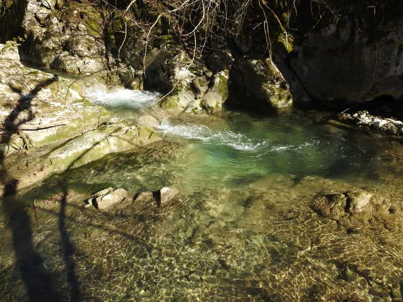
The Kotline
The Kožbanšček brookbed just before the Kotline,
22th May, 2010.
The Kotline
The first Kotlina (pool), against the flow,
22th May, 2010.
The Kotline
View of the first and the second Kotlina (pool), with the flow,
22th May, 2010.
The Kotline

All three pools, with the flow,
22th May, 2010.
The Kotline at High Water
At a the Neblo automatic hydrological station a discharge
was 5.66 cubic meters per second at the time of taking picture,
5th November, 2023.
The Kotline

View of the left part of the second Kotlina (pool), with the flow,
22th May, 2010.
The Kotline

View of the right part of the second and the third Kotlina (pool), with the flow,
22th May, 2010.
The Kotline
All the Kotline, which were eroded by an extremely high flood during the night
The third Kotlina and the fourth pool, carved out by the flood from the previous image,
The Kotline
The second Kotlina (pool) in a snow, with the flow,
The Kotline
The second Kotlina (pool) in a snow, against the flow,
The Kotline
Smooth surface of cracked calcarenite (limestone sandstone) belonging to the Upper Cretaceous
The Kotline
Interestingly shaped layers of calcarenite, 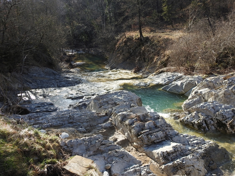
between Sunday, 16th, and Monday, 17th November 2025,
1st February 2026.
The Kotline
1st February 2026.

18th December, 2010.
18th December, 2010.

(Santonian) between 85.7 and 83.6 million years old.
22th May, 2010.
22th May, 2010.
Matevž Swimmer Once Again
Matevž and Samo behind him were warming themselves in the sun after swimming in the Kotline.
Samo Grgurevič, Matija Perne and Misha also swam here.
Misha enjoyed the cold water for about 10 minutes,
others swam and quickly retreated into the sun.
The water temperature was around 14 degrees Celsius,
5th April 2026.
This picture was taken by
Mikhail Tertychnyi, Misha.
He owns all rights to it ©.
The Kotline are popular summer bathing spot of youth of the Brda region,
as well as the elderly like to refresh in warm water, which is heated by the Sun from morning to evening.
The pools are deep up to two and a half meters.
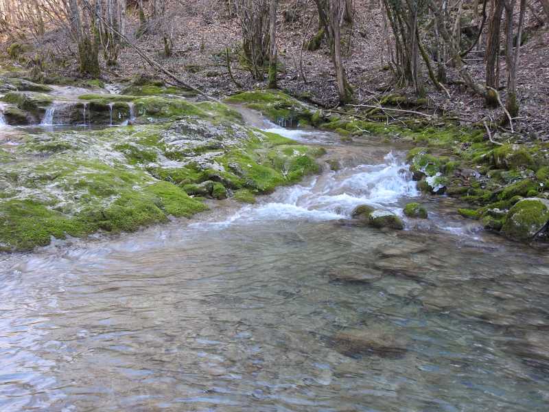
The View of the Evorsion Channel Gorge in the Right Branch of the Belski Potok
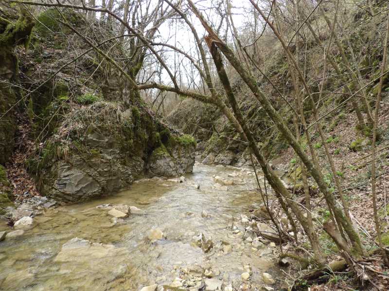
The Belski Potok is left tributary of the Kožbanšček.
The Potok is well preserved, we can talk about its conatural conditions.
3rd April, 2018.