 Evorsion Channel Gorges of the Soča
(19 pictures)
Evorsion Channel Gorges of the Soča
(19 pictures)
1990, 1 picture;
2005, 1 picture;
2006, 2 pictures;
2007, 1 picture;
2008, 1 picture;
2011, 1 picture;
2013, 1 picture;
2015, 2 pictures;
2017, 1 picture;
2018, 2 pictures;
2019, 1 picture;
2020, 3 pictures;
2021, 2 pictures;
all of them are 1000 x 750 pixels in size.
Page, texts and photos copyright (c) Daniel Rojšek, Danč, 1990-2025,
In your e-mail application . is to be changed to @ and
at the end of e-box delete <>.
This web intruders do not know, yet.
The Soča has formed eighteen evorsion channel gorges in her riverbed.
Her tributaries have created at least ten times as many.
You can see all of the Soča below. They follow each other with river course.
Evorsion Channel Gorge of the Potok above the Skok Waterfall
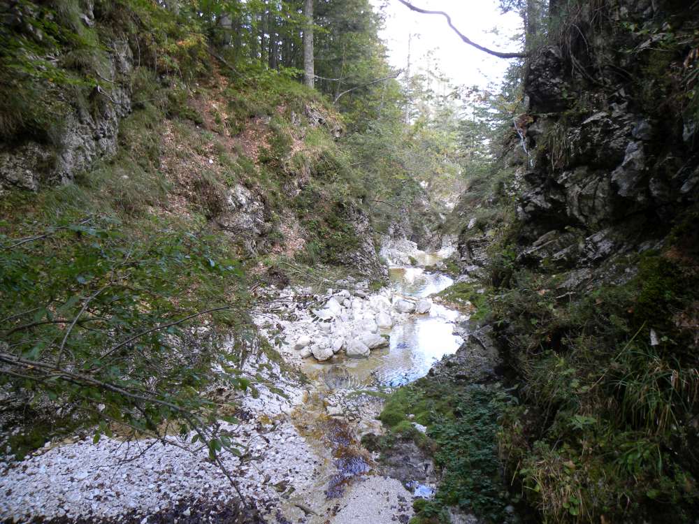
The Soča is called the Potok at her source area.
These channels are about 260 m long, from 6 m to 40 m deep and from 1 m to 15 m wide.
There are three waterfalls and water jumps.
At the enda their bottom becomes a precipice.
From the mouth of the channels the 73 m high Skok falls into the lower channels.
The Skok is second highest waterfall in the Triglav National Park.
The highest is in Kloma, 100 m high, but has very little water in the summer.
This and the next channels and that one above the confluence with the Limarca brook, have been eroded by water into massive and compact
dolomite and limestone of Carnian age (around 225 millions years).
16.th September, 2011.
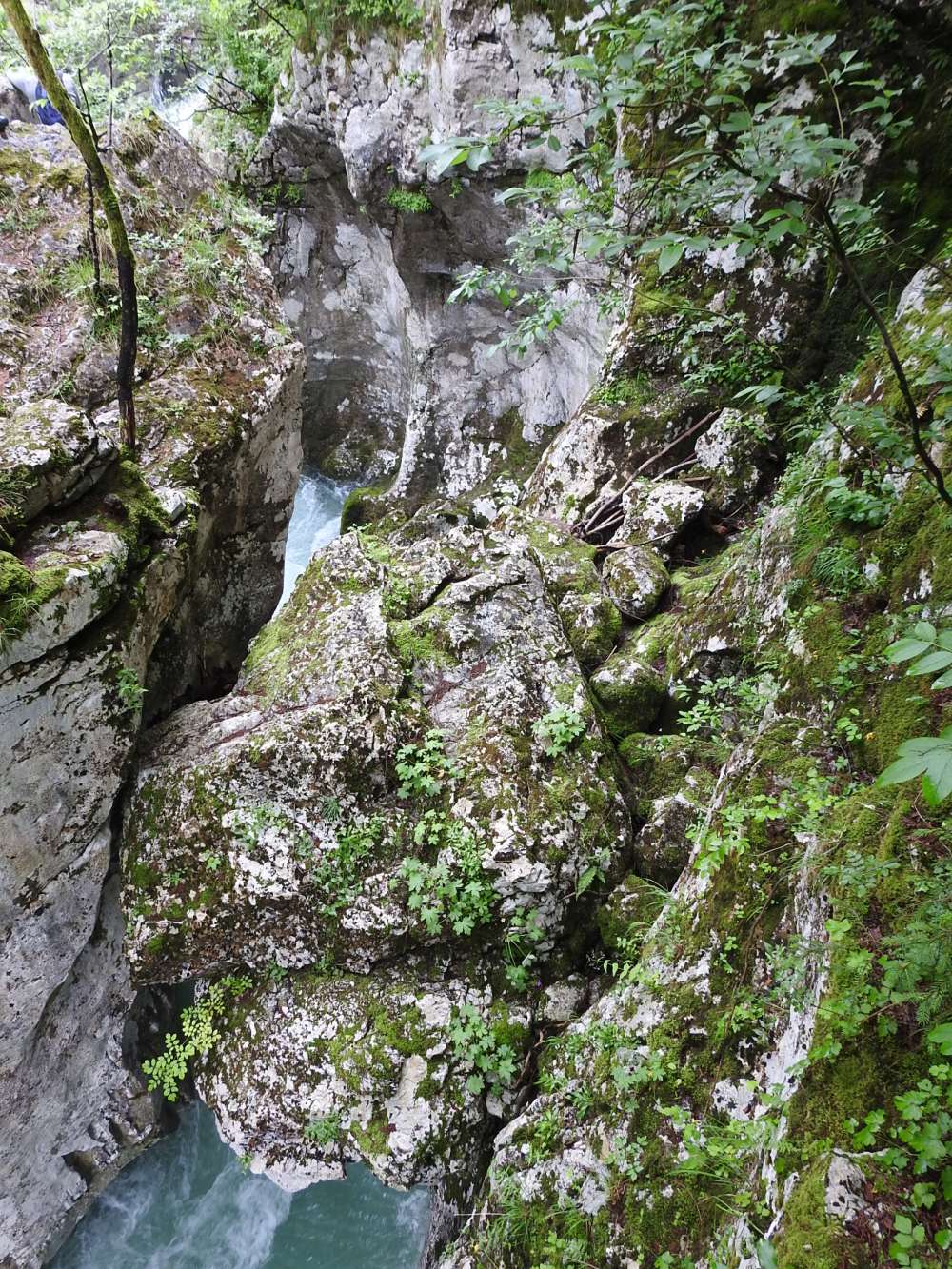
Evorsion Channel Gorge of the Potok below the Skok Waterfall
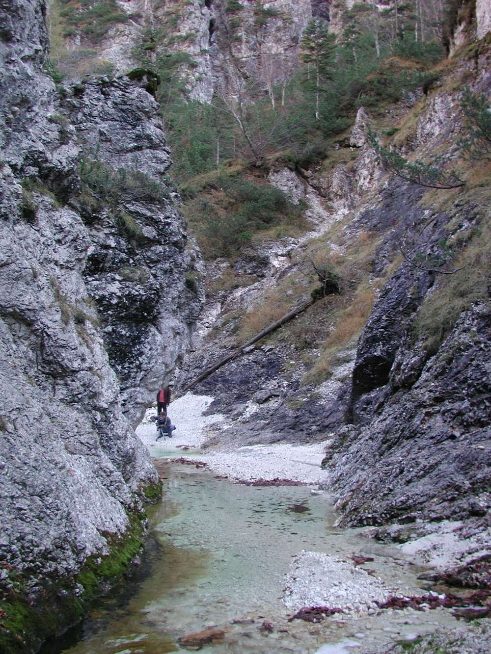
The channels below the Skok is about 100 m long, up to 50 m wide and up to 100 m deep.
You can get into it at low water via the glacial trough
above the last three waterfalls of the Potok, but below to the Skok you can not go without appropriate clothing for deep and cold water.
Otherwise, they are quite passable, despite the smaller jumps and intermediate pools.
Interesting are very small
Zois's bellflowers (Campanula zoysii). The flowers measure from 5 mm to 12 mm,
the usual ones are much larger. The plants grow out of rock cracks on the walls of the bed,
20th October, 2008.
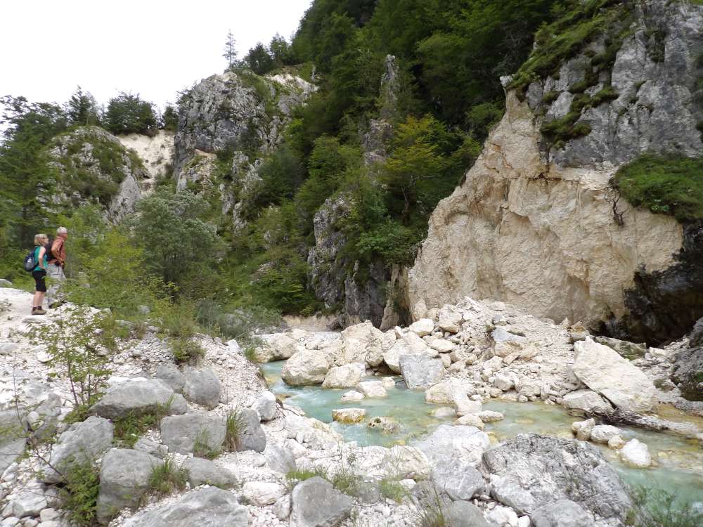
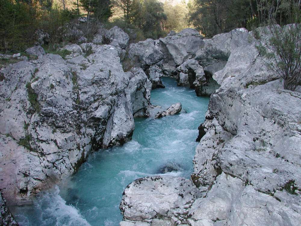
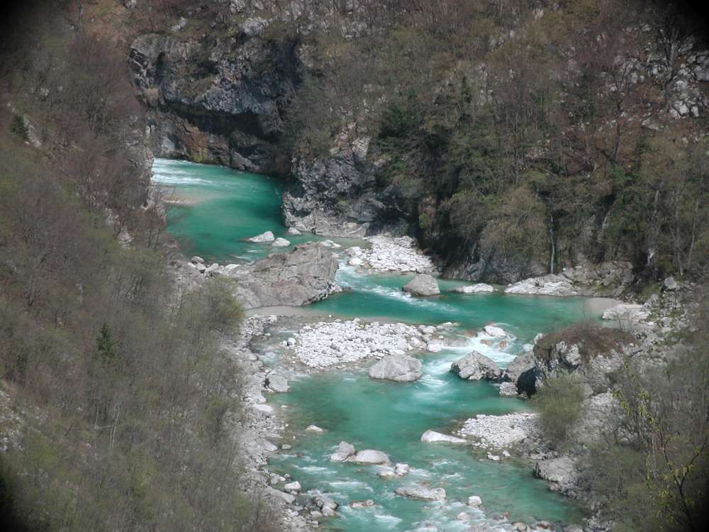
Channels above the Confluence with the Limarca Brook
The Soča has carved out a 25 m long and 2 m wide channels in the dolomite.
On the left side, there is a 5 m deep, while on the right, a 30 m high precipice wall
next to it. At the mouth of the Korita lies a pyramid-shaped boulder, below which the Soča falls in a 6 m
high waterfall into a pool about 6 m long and over 2 m wide; in it, we can observe picturesque scenes created by the sparkling water.
On the left side of the channels the glacier deposited quite large rounded rocks.
Among them, a rock made of porphyry, a reddish rock that was spewed by a
volcano at the bottom of a 2000 m deep sea about 240 millions years ago, stands out. It came here from a deposit about 500 m higher.
The picturesqueness of the channels is complemented by plants. They are mostly covered with dwarf mountain pine
(Pinus mugo).
In the spring we are delighted by the yellow flowers of the beautiful
mountain cowslip
(Primula auricula)
and the delicate flowers of
the smallest snowbell (Soldanella minima).
23rd December, 2015.
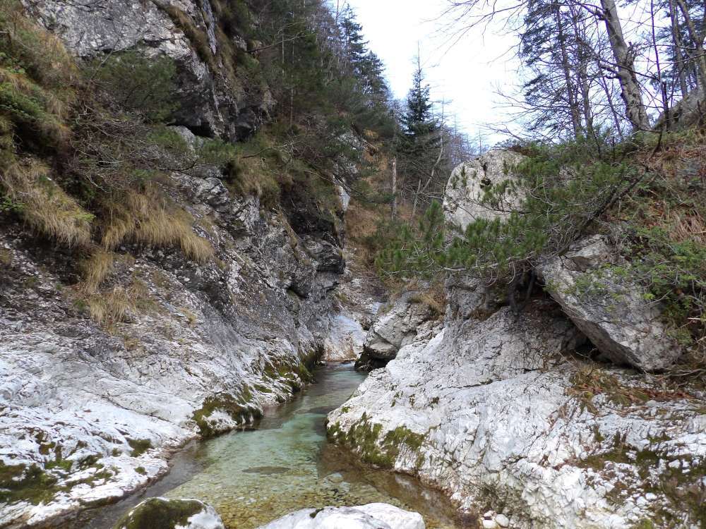
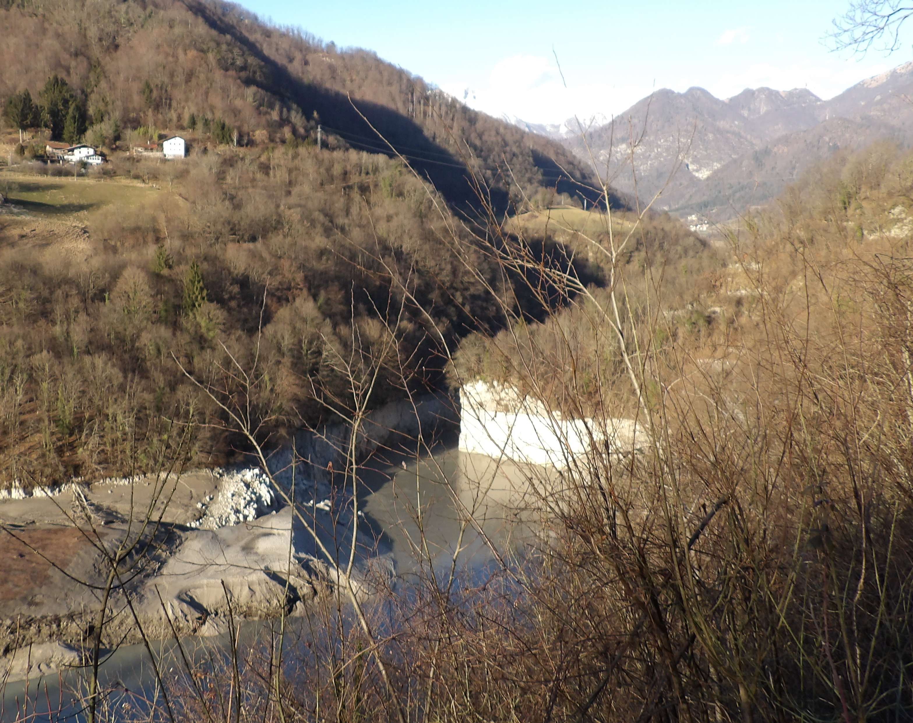
Channels U tesneh
U tesneh the Soča Valley ends and the Trenta Valley begins.
The Slovene name suggests that it is a narrow valley which was created by
a glacier that left behind a huge amount of rock and scree as it retreated. This moraine builds up the left side, while on the right is
exposed approximately 210 millions year old Triassic dolomite, which weathers at different speeds. The more resistant parts create
picturesque, rocky columns or obelisks, and in between are the Meli (scree).
The channels was disclosed by the spring high water in the year 2017.
At the end of winter the left wall collapsed into the water, pushing it to the other side, where it washed away the rock and gravel. With this
exposed the bedrock dolomite on the right side as well.
They are about 40 m long, 10 m to 20 m wide, the deepest on the left side is from 20 m to 50 m, and on the right only from 2 m to 4 m, rocks
and gravel are raising
above their wall. The dolomite of the right wall is heavily crushed and quickly disintegrates.
Fifty meters before the channels
a footbridge crosses the Soča River, from where there is a beautiful view on the river. The channels is partially covered by willows.
We can see them from the Soča Path, which takes place above them.
27th July, 2017.
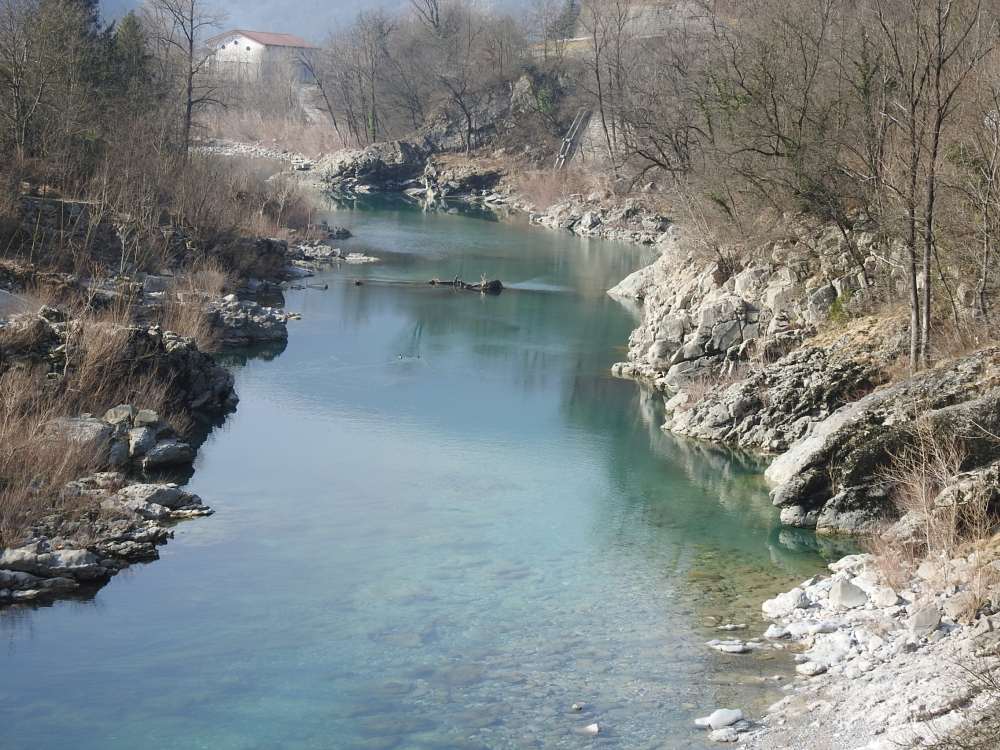
The Mala Korita
The Mala Korita or Pri Brvcah is the fifth channels downstream from the source.
They are 250 m long, on average 4 - 5 m, up to 6 m deep, and on average 2 m wide.
In the narrowest part is less than a 1 m wide, and the widest (7 m) is at the pool, approximately in the middle of their course.
In the inflowing mouth they have a very steep slope, as they deepen by 4 m at a distance of 10 m.
The water rushes in rapids and later calms down in large pools.
The bottom of the Soča riverbed in front of the Mala Korita is at the height of the upper walls of the channels,
which is a big specialty!.
The Soča River hollowed out them into compact limestone of Jurassic age (between 176 and 200 millions years old).
The channels is crossed by a bridge on the road leading to the Vrsnik or Na Skalo.
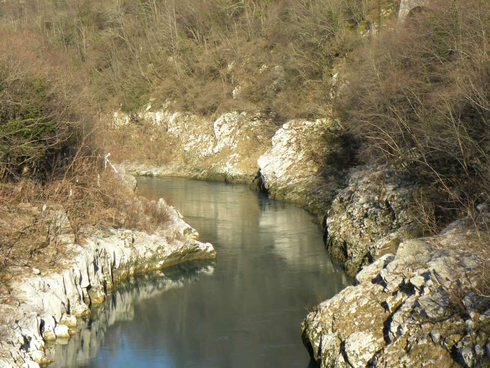
12th October, 2006.
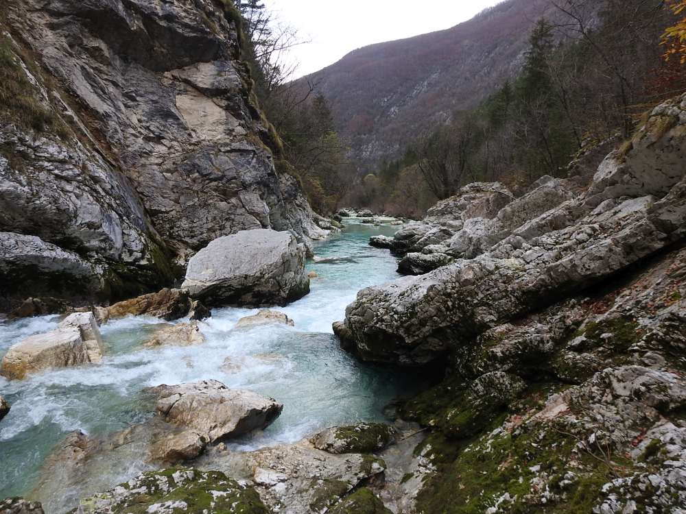
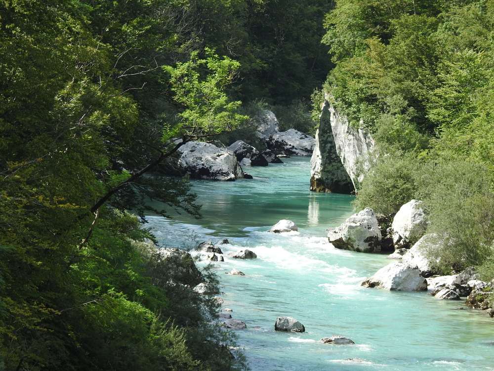
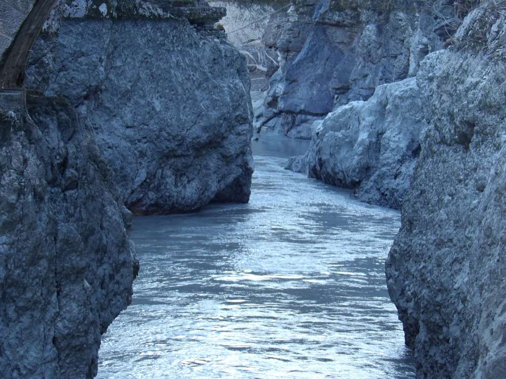
The Velika Korita
The Velika Korita is
carving by the Soča River into the layered, Triassic, Dachstein limestone, about 210 millions years old.
They are 800 m long, 10 - 15 m deep and in many places only a meter wide. At their widest places they reach 7 - 8 m.
In The Korita, the Soča flows in a mighty swirling stream from one evorsion pot to another,
grinding the bottom and walls with rotating stone debris, which are therefore smoothly rounded.
In several places, rocks are wedged, creating natural bridges.
Under the footbridge, small waterfalls fall from the stagnant water - fed by nearby springs - from the right into the
Korita. The water fluctuates for a good 10 m and overflows them during floods.
In the outflow mouth of the Korita, we can observe karst kamenitzas and numerous fossils of megalodon shells.
About 140 m below the inflow mouth, they are bridged by a footbridge,
and a good 50 m before the outflow mouth, by a road bridge towards the Lepena valley and settlement.
9th June, 2020.
The Korita pri luski
A big rock slab has slid down in a steep left slope by a good 10 m into the riverbed,
in the lower part of the Soča Valley.
The slab is about 50 m long, up to 60 m high and up to 10 m thick. An interesting and rare natural phenomenon.
The slab forms their left wall in the inflow part of the korita.
They are about 100 m long, the right wall is from 5 m to 10 m high, and the left wall is up to 60 m.
At the inflow mouth they are 20 m wide, at the outflow 15 m, the narrowest (5 m) are near the outflow mouth.
The Soča River carved them out of the stacked Dachstein limestone with layers and dolomite inclusions, around 210 millions years old.
13th November, 2020.
The Zmuklica or Ghjekrlca
The Zmuklica or Ghjekrlca, also known as the Korita pri Kršovcu, is 150 m long and up to 10 m deep.
Approximately in the middle they widen into a pool, which is up to 10 m wide and 20 m long
(we can see it in the picture at high water). Below it, in its narrowest part, they are only a meter wide,
while 6 km away, the water spreads 600 m wide over the Čezsoški Prodi in Vrbulje during floods.
A special feature of the Zmuklica is mentioned large pool, where the water calmly "boils" between the fast and foaming inflow and outflow.
This Korita was also evorded in the Upper/Late Triassic, stacked Dachstein limestone with layers and dolomite inclusions,
which is about 210 millions years old.
A footbridge crosses them approximately in the middle.
A tunnel was dug in the right wall of the Korita in the second half of the thirties of the twentieth century.
One of the floods before the year 2009 washed away a large amount of scree through it. This hole can be seen above the inflow mouth.
The upper entrance to the tunnel was opened as a small hole when it was completed.
The entrance was not widened due to the scree above it, as the scree would have had to be consolidated first.
This tunnel was probably dug for a power plant with a machine room on the right bank of the Soča River
below the village of Koritnica. It would have been used to bring water from the dams in the Kluška Korita /certainly/
and from in front of Zmuklica. The HPP started to built the Italian private company SAFI, but fortunately
it was not completed due to the Italian attack on Ethiopia in October 1935 ond World War II.
4th November, 2021.
The Korita nad Otonam
They are located above the most beautiful pools of the Soča River, where she still retains her wild primalness.
The Korita are 100 m long, up to 50 m deep and from 25 to 45 m wide.
The Soča River "ate" them into the Upper Cretaceous flysch, which is about 65 millions years old.
The structure here is interesting because internal, terrestrial forces lifted the relatively young Upper Cretaceous flysch very high.
The rocks in the immediate vicinity are significantly older.
The Slovene dialect name for the pool is oton. The geographical name is plural (pri Otoneh, k Otonam).
Well, because it is also about three otons.
6th April, 2007.
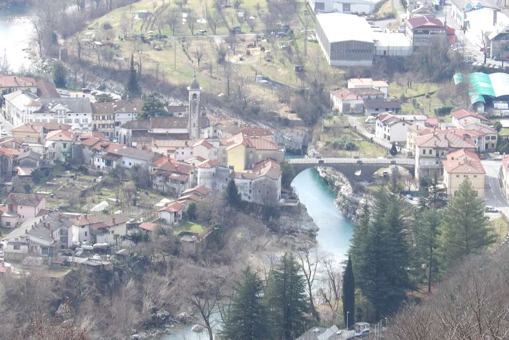
The Korita pri krokodilu
Of course, there are no crocodiles in the Soča, "yet". Namely, the rock below the right wall is shaped like a head of crocodile.
We see it under the illuminated top of a tree, which is stretching towards the middle of the river.
These Korita are very short but picturesque, 45 m long, up to 20 m deep and just as wide.
The Soča washed out this and the following Korita in the stacked Dachstein limestone with layers and inlays of dolomite,
about 210 millions years old.
6th August, 2020.
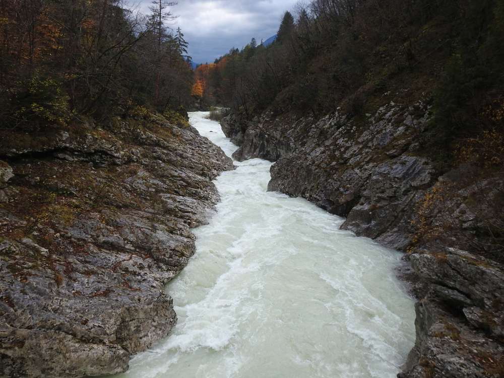
The Korita pod Napoleonovim mostom
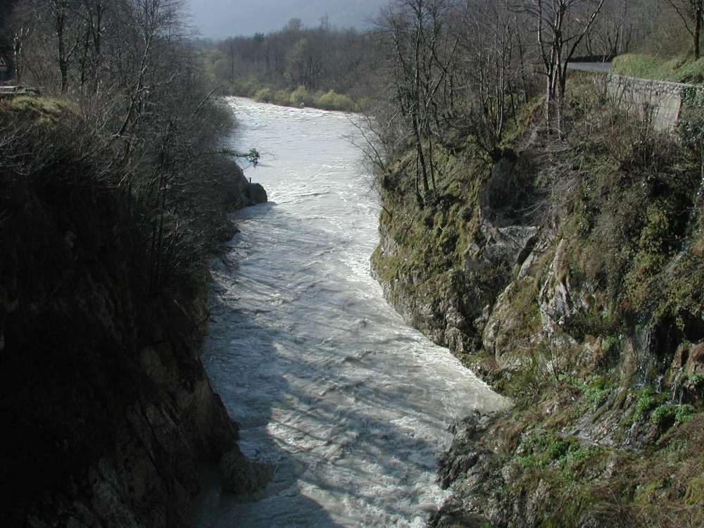
The outlet mouth at spring high water.
The upper course of the Soča River ends here with approximately 250 m long, up to 20 m deep and
the narrowest part only 2 m wide Korita (under water). They are the widest in the outflow mouth,
approximately 25 m.
They are characterized by large evorsion pots on the walls high above the low water surface and
in the inflow part by vertical layers of limestone called the Cepljena skala.
Here, the layers cross the river at an angle, and the rock is dissected here by vertical cracks and has a large gap.
After the rapids, the water stops for a while in a "bay" or pool.
Geographer and historian Simon Rutar wrote in the Zgodovina Tolminskega
(History of Tolmin area, published in the Gorica 1882) on page 286:
"... The most cramped is the Soča riverbed under the Kobarid bridge, where the water flows deep
between two rocks and flies like an arrow from a narrow quiver ..."
11th April, 2006.
The Korita pod Miriščem, the First Picture
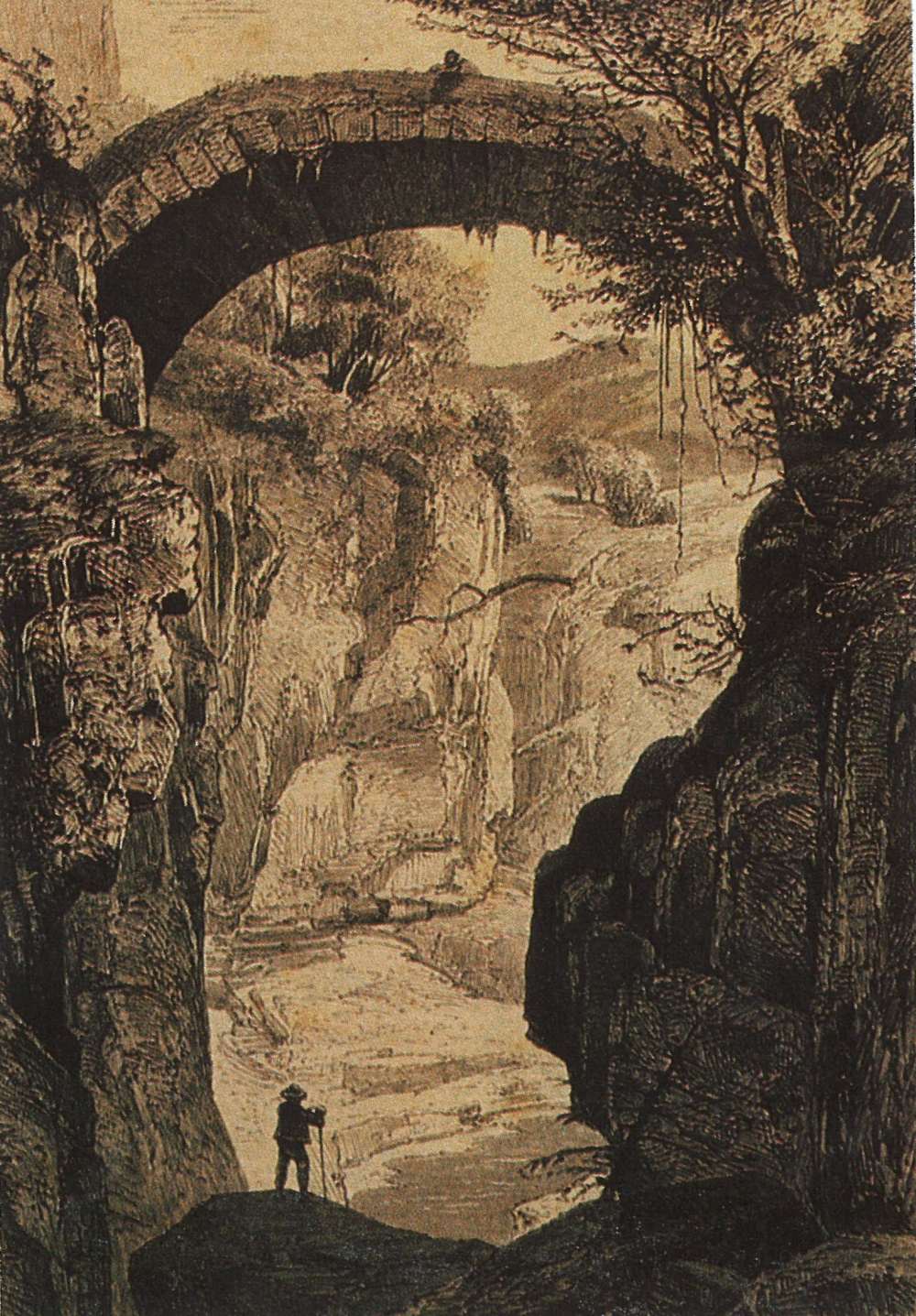
To these Korita which were flooded with the artificial lake
I have dedicated two pictures, because they are exceptional, regardless of the damming.
The Soča River has carved this and next Korita into Upper Cretaceous coarse-grained limestone
breccias with marl inclusions, about 70 millions years old.
The picture shows their characteristics before flooding. They are
150 m long. At their narrowest point - right under the road bridge - they are about 6 m wide.
At the normal water level in the artificial lake, only 4 - 5 m of the walls on the left side are visible from the water,
while when the reservoir is empty, it is about 15 m.
The Korita were painted by the Czech artist František Bohumír Zvěřina between 1864 and 1866,
when he was teaching at the gymnasium in Gorica.
He called the picture "The Roman Bridge." I took it in front of his memorial room in Hrotovíce, Moravsko-Moravia
on 2nd October, 1990.
The bridge was destroyed during World War I.
"... Soon the riverbed narrows again and the water rushes in great leaps towards the Sv. Lucija Bridge.
From this 34 m high bridge it is very interesting to observe the deep, roaring and foaming water.
Some 200 metres lower, the Idrijca and Soča rivers join.
The beds of both rivers are up to 30 or more metres deep, embedded in solid rock, but only 4 - 6 metres wide.
In this rock, the water has hollowed out round pots, where it then stops and swirls as if boiling.
Here and there, big rocks also lie along the riverbeds. ...
For every foreigner, the confluence of the Idrijca and Soča is a very interesting and pleasant natural beauty."
Simon Rutar (1882: 287).
The Korita pod Miriščem, the Second Picture
The Korita at the empty lake. We can see only 15 m of the walls, as Korita
are filled with gravel 20 m thick and flooded with water.
18th January, 2018.
The Korita between Kozmerce and Drobočnk
The Korita when the lake is empty. They are about 60 m long, 10 m to 20 m wide, and up to 70 m deep.
Below their outlet mouth, we see tens of meters of sediment.
18th January, 2018.
The Korita above the Confluence with the Ušnk Brook
The Korita were harmed by the Doblar hydroelectric dam, about 180 m below the inflow mouth.
They are about 400 m long are widest at the inflow mouth, as much as 70 m, and at the outflow mouth they are only 30 m
wide. This is a special feature of korita. Usually it is the other way around,
they are widest at the ourflow mouth, and narrowest at the inflow mouth. This are 70 m - 80 m deep.
The Soča River carved this and the following Korita into the Upper Cretaceous micrite limestone, about 80 millions years old.
3rd November, 2015.
In the Gorge Nad Koriti
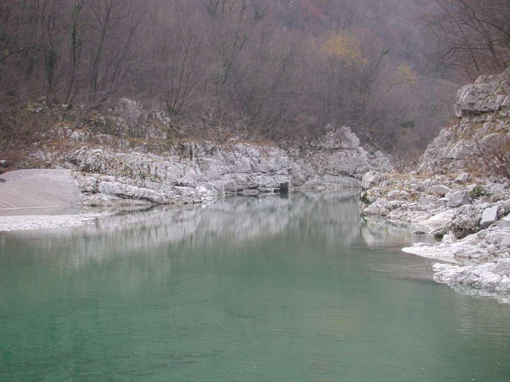
Nad Koriti (above Korita) the natives call the Soča gorge between its confluences with the Ušnk and Doblarc
brooks, after these Korita in the picture above and the next on this website.
These are about 200 m long. At the inflow and outflow mouths are 35 m wide. They are 20 m - 30 m deep.
The river flow is greatly reduced, mainly due to the Doblar hydroelectric power plant.
2nd December, 2005.
The Korita above the Toplice
In the Soča darinage area, we know two warm springs in the Tminska Korita and Toplice.
I named these magnificent Korita after them. Up to 24oC warm water springs on the right bank 100 m below the outfrow mouth.
They are even 1600 m long. At the in- and out-flow mouths they are 35 m wide. The Korita are 20 m to 50 m deep.
The longest Korita in the Soča region were devalued with the engine room of the Doblar power plant,
which was built in the right wall of them at the confluence with the Doblarc brook.
The flow is mostly severely reduced in the first 600 m due to the Doblar hydroelectric power plant,
and fluctuates a lot in the lower, kilometer-long section.
They are crossed by a road bridge between Avče and Ročinj.
Remains of a footbridge between Ročinj and the Avče railway station disfigured them.
Ii is hard to decide whether the Korita pod Miriščem and these are single, locally widened korita or five independent ones.
I decided on the second option, each Korita is carved into limestone with distinct precipitous walls.
In between are widened parts of the riverbed, with precipitous banks made of various rocks,
but without the basic characteristics of other Korita of the Soča.
The Soča River has carved this and the following Korita into the Lower Cretaceous limestone breccia, which is about 110 millions years old.
31st January, 2013.
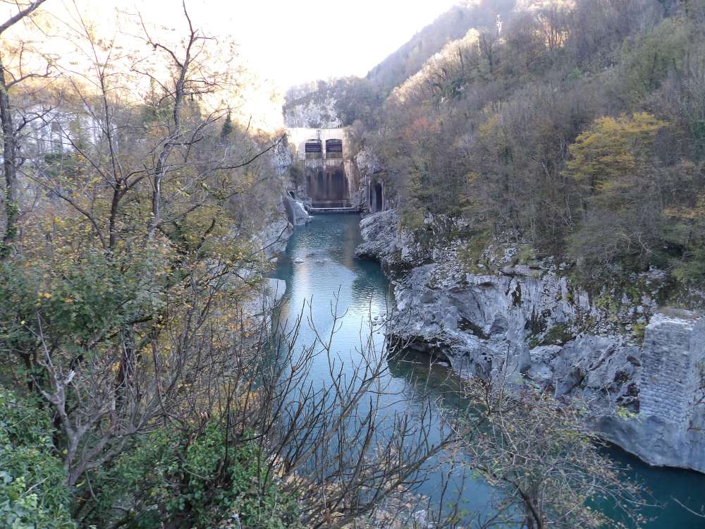
The Kanavska Korita
K'nu or Kanu, officially Kanal, is the most beautiful town on the Soča River, mainly because of the Korita.
The settlement was built as a fortified crossing over the river.
Korita were carved by the Soča in the Lower Cretaceous limestone. This one is between 112 and 125 millions years old.
They are 400 m long, the narrowest in the inflow part (15 m), they begin to widen at the right tributary of the
Gorevšek brook, and the widest at the outflow mouth (50 m); on average are 10 m deep, with a maximum depth of 15 m.
On the left side are the highest. The rocky bank at the top of the Korita
was densely built up. A little above the southernmost fortification tower
(only the foundations have been preserved) stairs were cut into the wall.
The only ones in all korita of the Soča.
The right, rocky flat area above them is lower.
The nearest houses are 25 m away and flood waters are flowing over this area.
On both sides, water has evorded numerous, rather big pots into the walls and
kamenitzas (karst, shallow depressions with steep and sharp edges) are also common.
The water is over 10 m deep, and the flow is very low for most of the year due to the Plave hydroelectric power plant.
In the inflow part, they are crossed by the bridge of the Nova Gorica-Tmin state road.
5th March, 2019.
The D'sklanska Korita
The last Korita of the Soča River in Deskle are about 150 m long.
They are narrowest in the inflow part (25 m), and 30 m wide in the outflow mouth. They are up to 10 m deep.
They were formed in Paleocene flysch, which is about 60 millions years old.
Here has the Soča the bigest erosive power and the flysch sandstone is not a very resistant rock,
so their walls are the most dissected of all korita of the Soča.
The water is up to 10 m deep, and the flow is very low for most of the year due to the hydroelectric power plants
in Plave and Lošce. However, flood waves with maximum flows - around 2400 m3s-1 -
completely overflow them.
23rd February, 2021.
The page from the 1st April, 2025 by
Daniel Rojšek, Danč.
Date of the last change:
14th November, 2025.
Your comments are
welcome.
In your e-mail application . is to be changed to @ and
at the end of e-box delete <>.
This web intruders do not know, yet.
Number of visits since the 1st April, 2025: