 The Soča with Tributaries, between Spring Areas and Outlets
(66 pictures from lectures)
All of the pictures are 800 x 600 pixels in size.
Photo and (c) Daniel Rojšek, Danč, 2011-2024, except
underwater image of Zmuklica (G0064301.jpeg) taken and copyrighted (c) by Žiga Dolinšek, 2020-2024.
Access to the Pages about The Soča
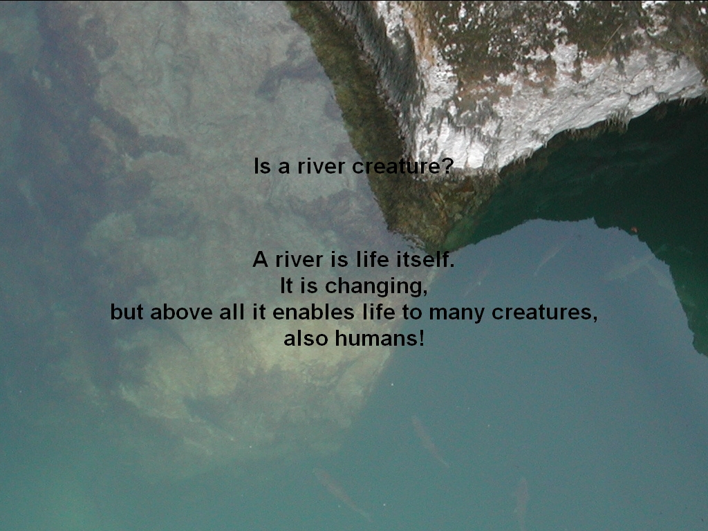
What is a River
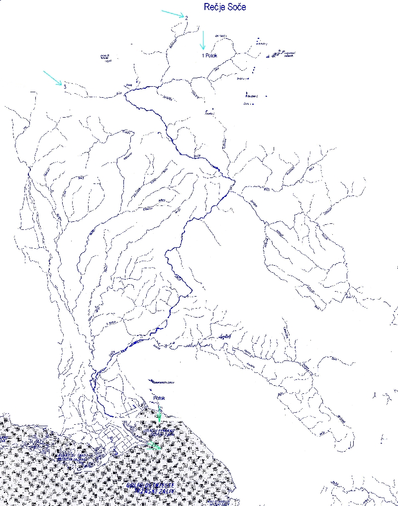
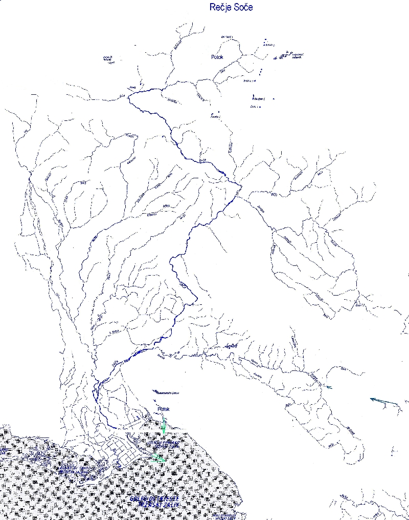
Map of the Soča River Network
The Soča river has three spring branches. The first is called Potok (1 and the arrow on the map), the second
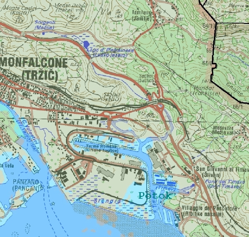
Koritnica (2) and the third Učja (3). Map of the Karst Springs and Outflow into the Sea
There are many karst springs on the NW side of the Kras (Carso) region.
The best known are Timav (Il Timavo) near Štivan (S.
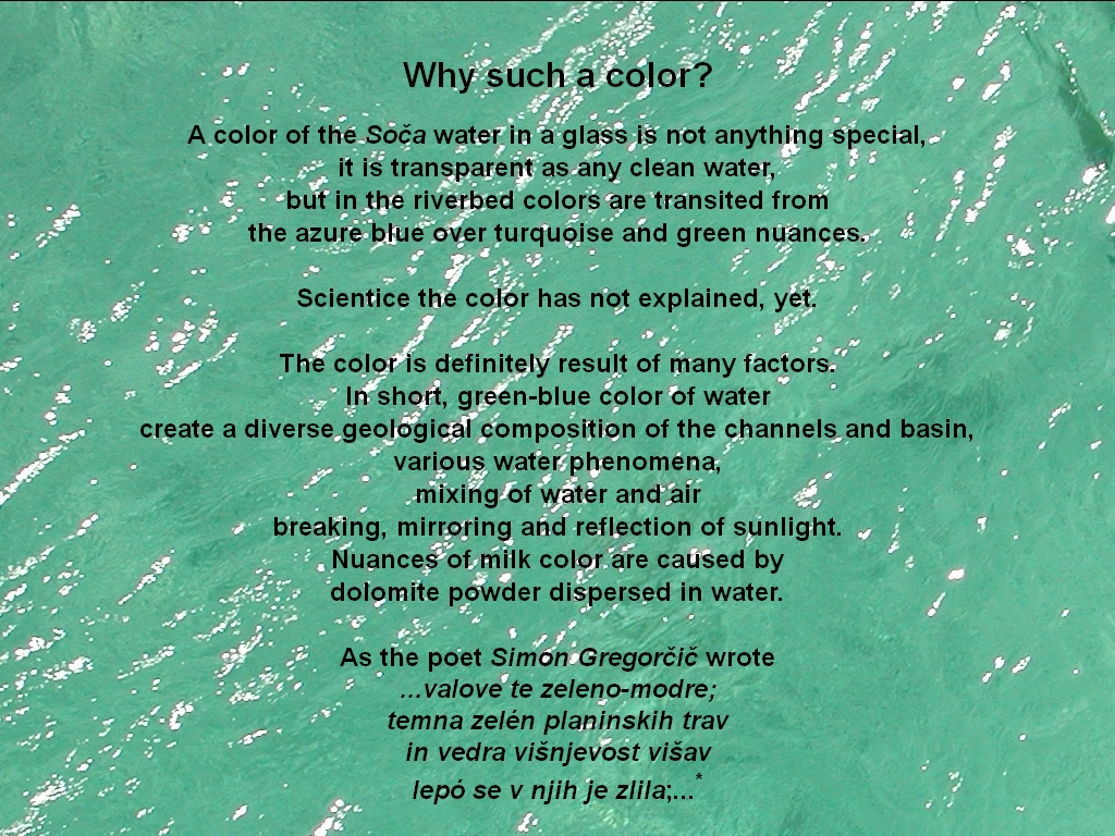
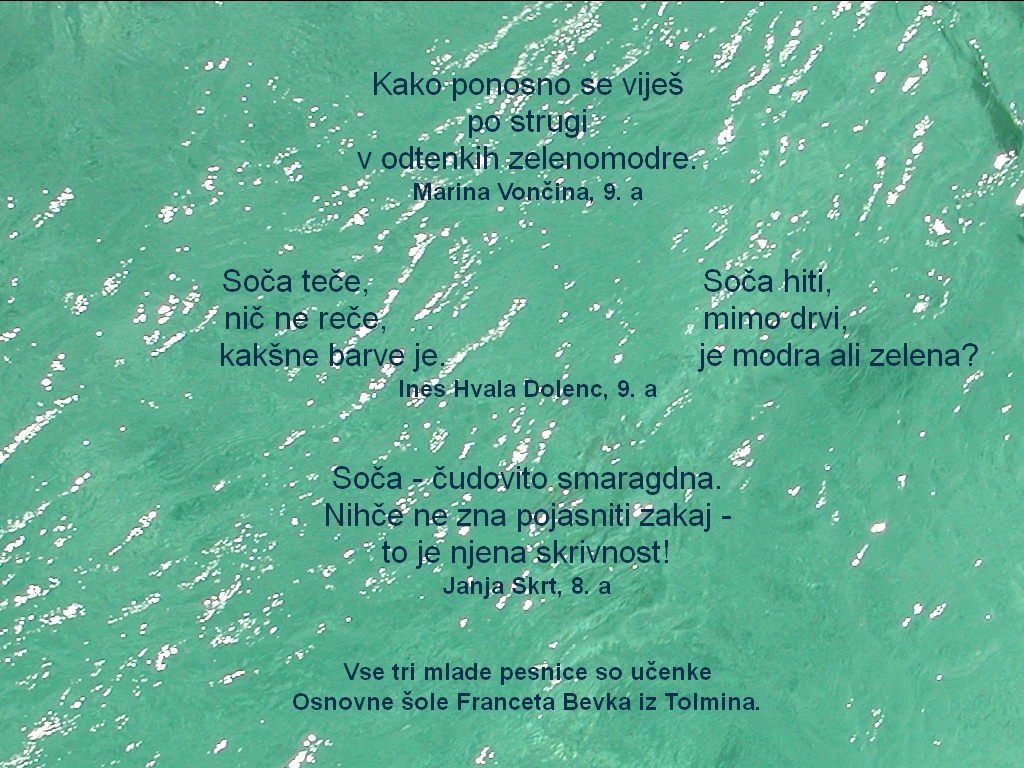
Giovani) and Laško jezero (Lago di Pietra Rossa) below Sabliči. Color of the Soča Water
* Sorry, the poem Soči has not been translated in English, yet.
Haiku
These and other haikus artists read at the Sotočje
(confluence of the
Tolminka river with the Soča) on Sunday, 14 October, 2012, to celebrate
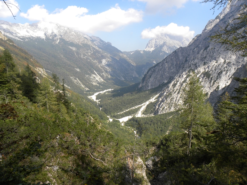
the Day of the Soča River. The Main Spring Branch
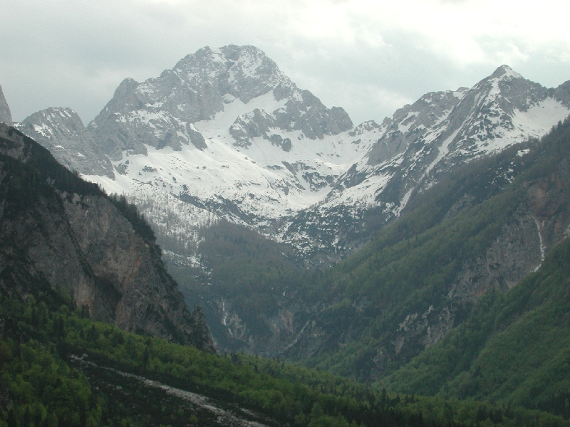
The main headwaters extending to a two-stage, wild cirque
between 1300 and 2300 m above sea level. Carved by the Soča glacier
under Mt. Bavški Grintavec (2347 m). The ice was here conceived before
9700 years ago in the lower Dryas.
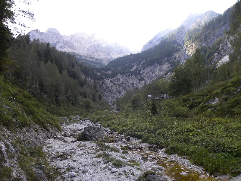
The Highest Permanent Spring
The main channel of the first Soča branch is called Potok. It excavated stream
at the bottom of lower cirque on the Zapotok
mountain pasture. Cottage and stables were
built above the first permanent source. It is situated about
1345 m above sea level.
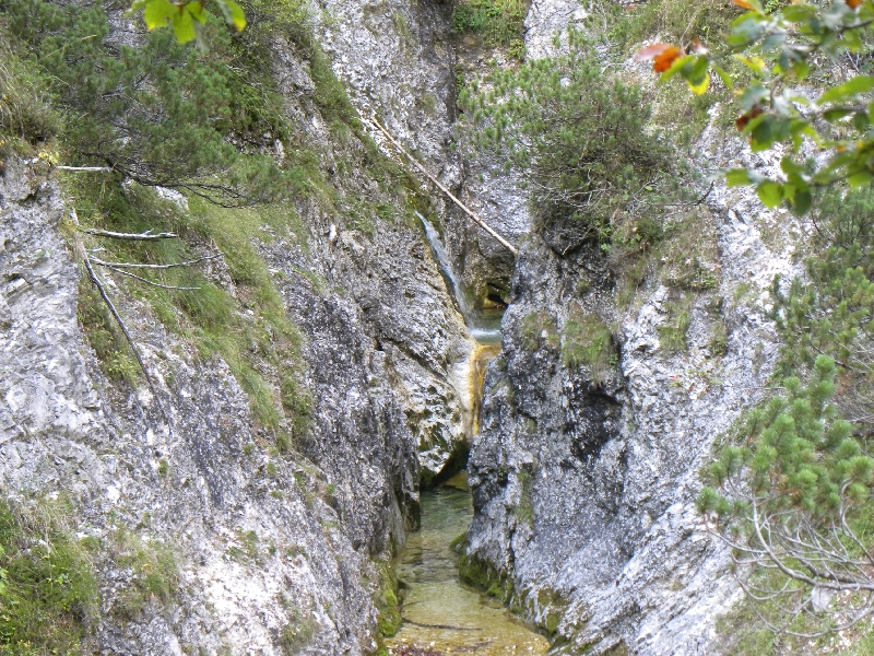
Evorsion Channels of the Potok
Approximately 15 m below and 300 m far below the permanent
source Potok burrowing into the rock about 260 m long, 6 m to 40 m
deep and 1 m to 15 m wide Korita = evorsion channels.
View in the Zapouden and the Vršič Pass
The Potok drops here over the Soča glacial trough in the
Zapouden, where it sinks in the own deposits and changes in
the Suhpotok (Drybrook).
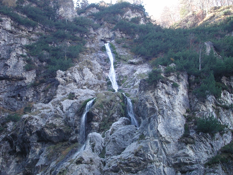
The Skok
From the mouth of Korita at the Zapotok mountain pasture
dropping 12 m high waterfall then the water is directed in a
slanted groove. Here glides 65 m and overcome altitude
difference of 45 m. At the very broken, steep ledge is
splits into two strands, and again dropping 73 m deep in the
Korita pod Skokom. Skok (The Jump)
is called this waterfall in Trenta.
The Highest Waterfall in the Korita pod Skokom
Water Fan in the Korita pod Skokom
The Suhpotok
View from Zapouden on the brookbed and the Vršič pass (1611 m) and Mt.
Prisank (2547 m) on the horizon.
Wet Suhpotok
After the heavy rains in the three-quarter-hour changes in the wet.
Six hours after the rains sinks again.
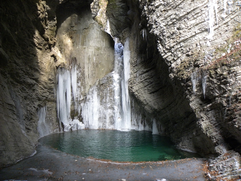
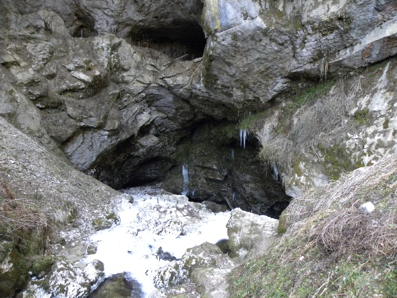
The Entrance to the Pothole of the Izvir Soče
The pothole of the Soča source was explored to a depth of 35.5 m; this
deepness can be reached during droughts. Passage filled with
water continues in the heart of Mt. Mojstrovka (2332 m).
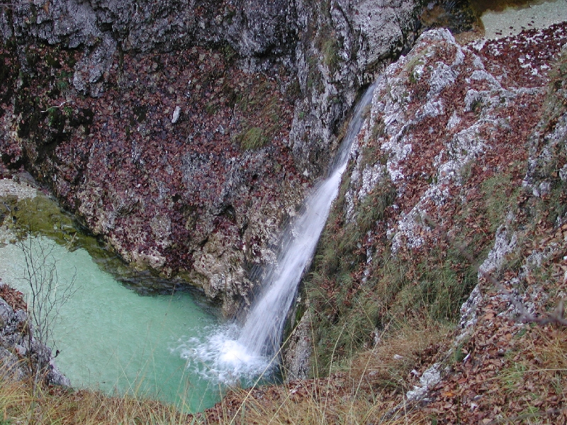
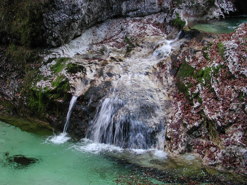
Waterfall of the Izvir Soče
After the spring water flows some meters by almost flat
surface and then it falls in about 10 m high waterfall
followed by cascades and rapids.
Full Brookbed of the Izvir Soče
In autumn is usually a lot of water.
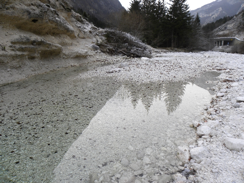
Dry Brookbed of the Izvir Soče
Brookbed of the Izvir Soče leading up to the confluence with the Soča river
regularly dry up, particularly in winters, during severe
droughts also in summers, what we see on the picture above.
The Soča Riverbed in Zapouden
From the bottom and hips of the riverbed runs at a distance of 50 m the whole river
at least twice more abundant than the brookbed of the Izvir Soče.
The river here never dries up.
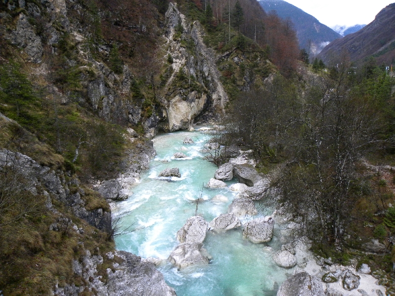
The Soča Riverbed Below the Confluence with the Izvir Soče
The Mlinarca
Just above the outflow mouth of the Korita Mlinarce collapsed about
a thousand cubic meters of the left wall in the January
2011. The rockfall has not dammed water of the Mlinarca
brook which from the left side enters to the Soča river.
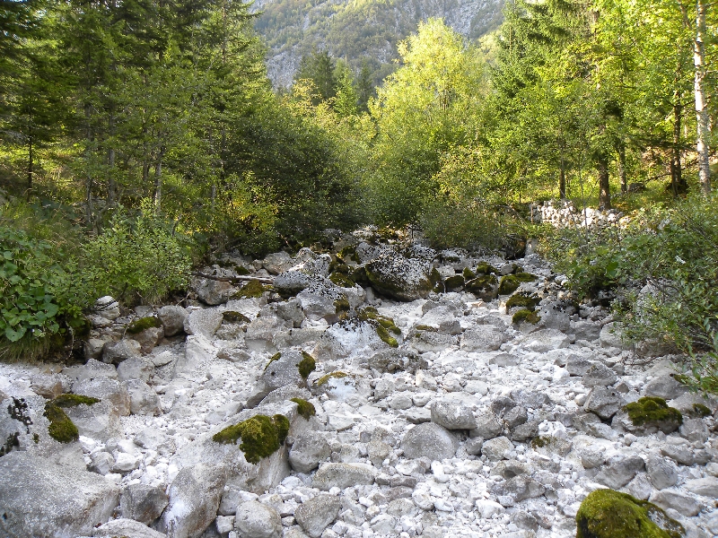
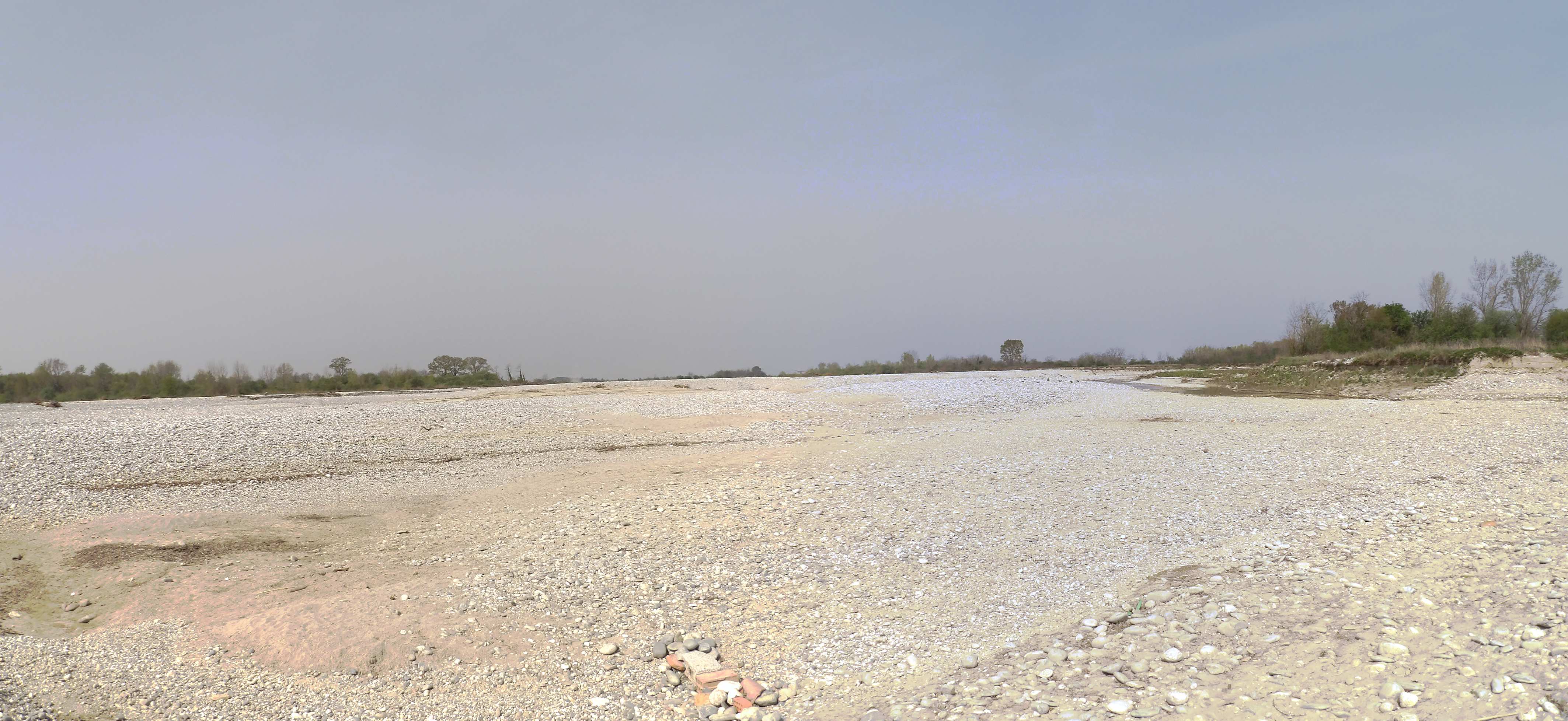
Dry Riverbed of the Soča Below Berbica
In the Trenta valley below the Berebica mountain pasture
(1250 m) the Soča river again regularly dries up to a
distance of about 700 m to 1 km, depending on water
conditions.
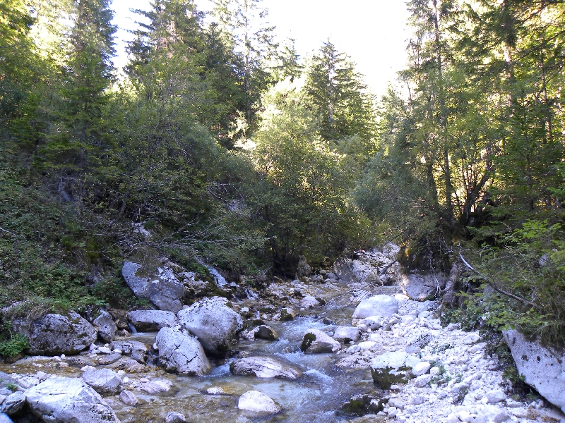
The V Tesneh
Here begins the Trenta valley and ends the Soča valley.
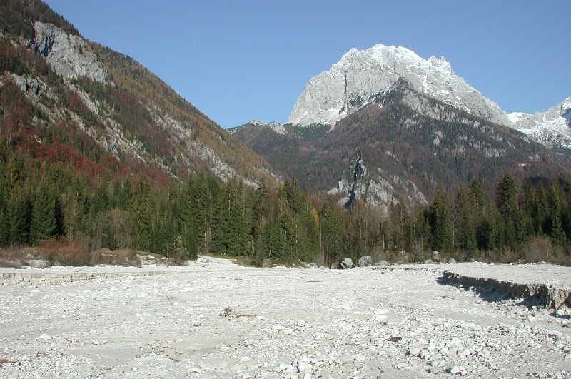
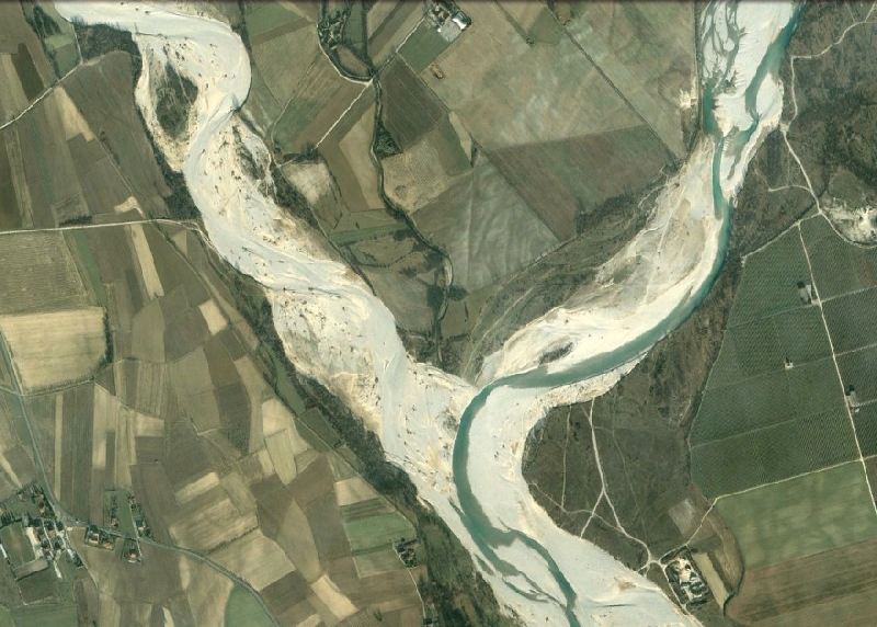
The Outflow Mouth of the Velika Korita
View on outflow mouth of the Velika Korita in the Soča valley is a little misleading, shows like that
river springs out of the highest mountain on the horizon. It
is not so, up to this point river flows nearly 18 km. The
highest mountain on the horizon is Mt. Bavški Gritovc
and below it is the Soča source in the neighboring
valley.
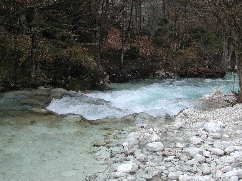
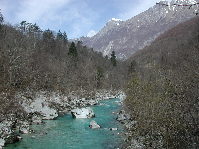
The Confluence of the Lepenca and the Soča Rivers
Below the confluence the Soča becomes fairly large river.
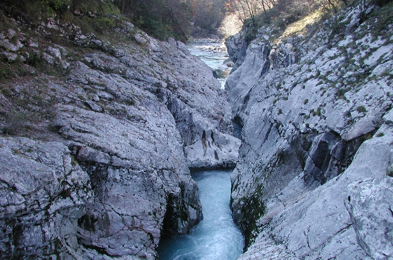
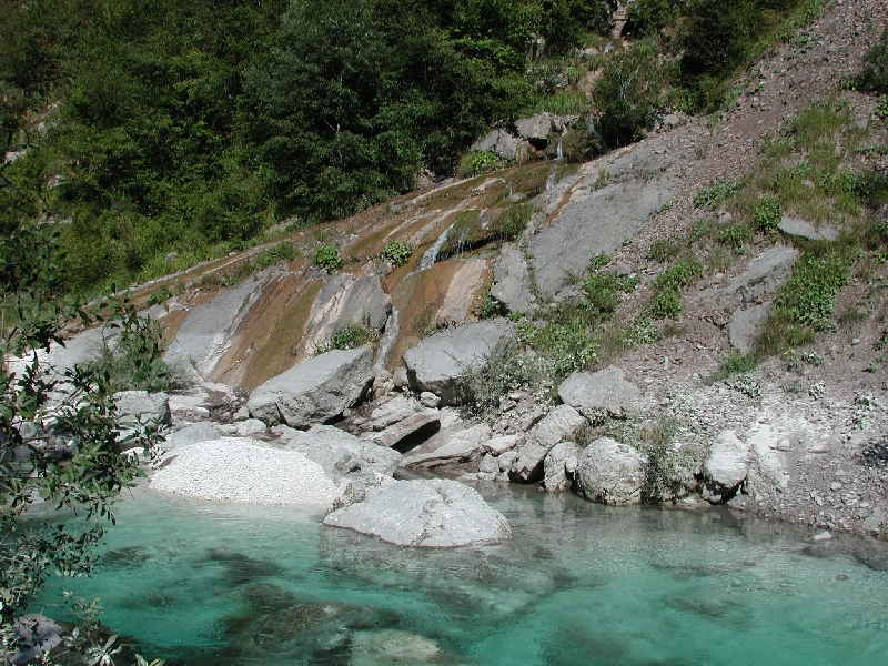
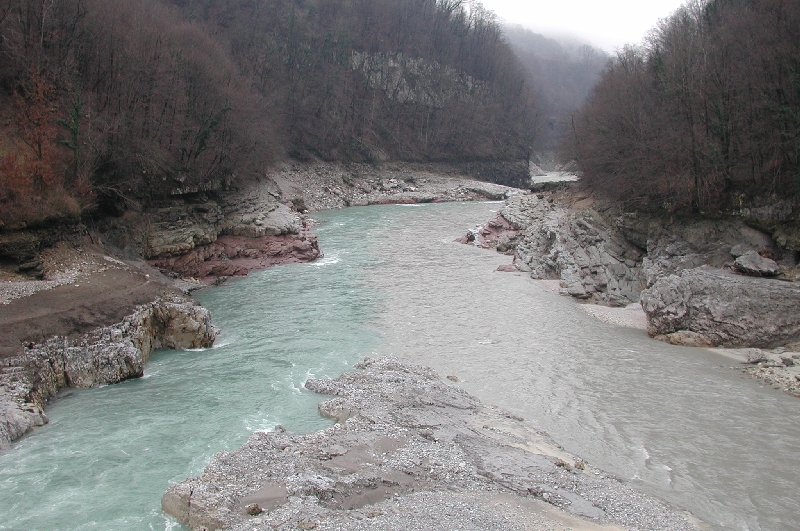
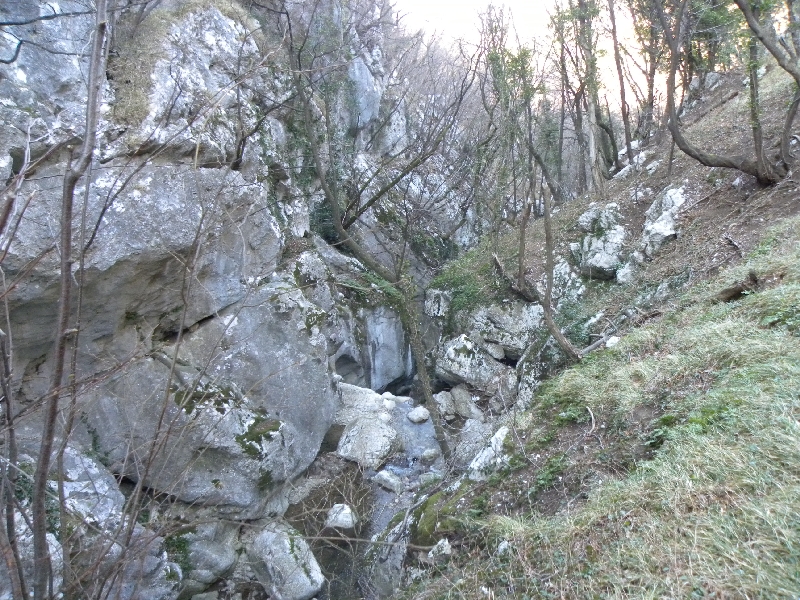
The Zmuklica or the Ghjekrlca
Zmuklica or Ghjekrlca is the name of about 150 m long and
15 m deep evorsion channels with 8 m deep water and very strong current at low flow.
Here the river left the
Soča valley and entering the Bovec basin. The narrowest
part of the channels is 1 m wide only, but 6 km far away on the Vrbulje and Prodi
area
the Soča river during floods spreads 600 m wide.
In the picture we can clearly see that the Korita are only a good meter wide.
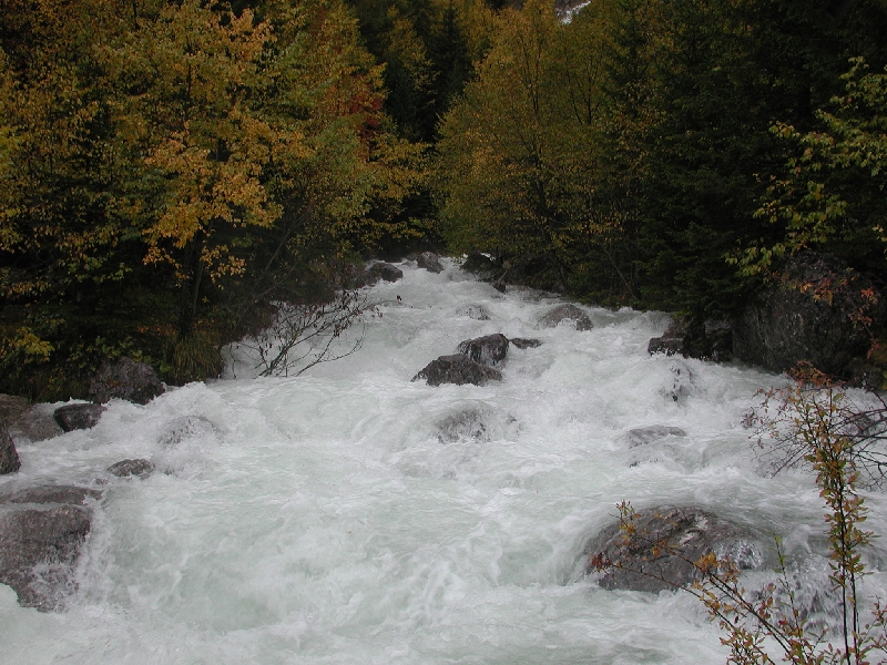
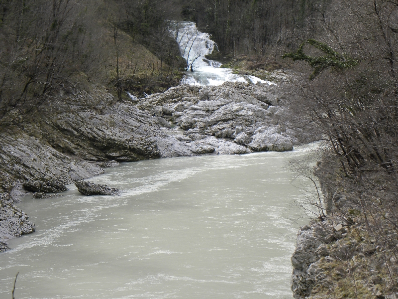
The Mangrškpotok
Above deep evorsion channels of Mangrškpotok brook rises
new bridge at Mlinč. The brook is left upper source branch
of the Predilnica brook. It is right tributary of the
Koritnica river. In the evorsion channels of the
Mangrškpotok the Predilnica brooks are many waterfalls.
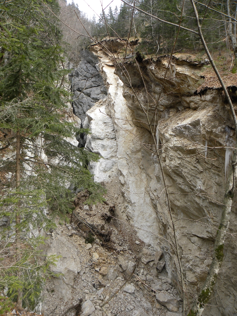
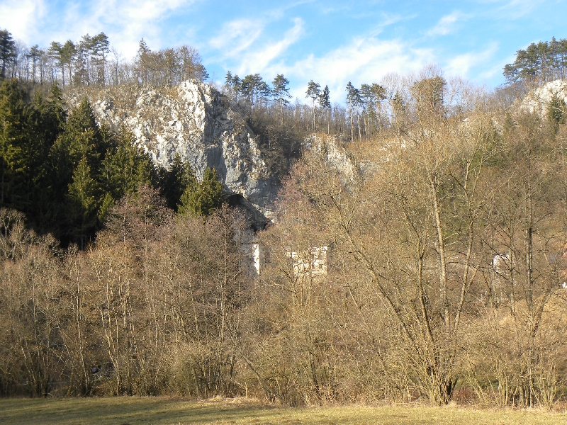
The Kluška Korita
The Koritnica, the second spring branch of the Soča river, has
excavated three evorsion channels. The most imposing are
below the fortress Kluže. Under the bridge, where I took
this picture Kluška Korita are 60 m deep.
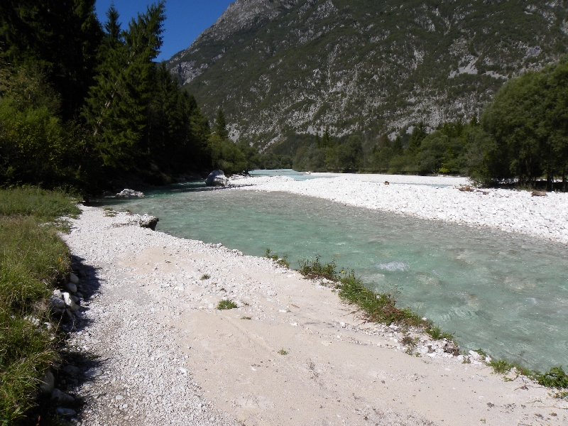
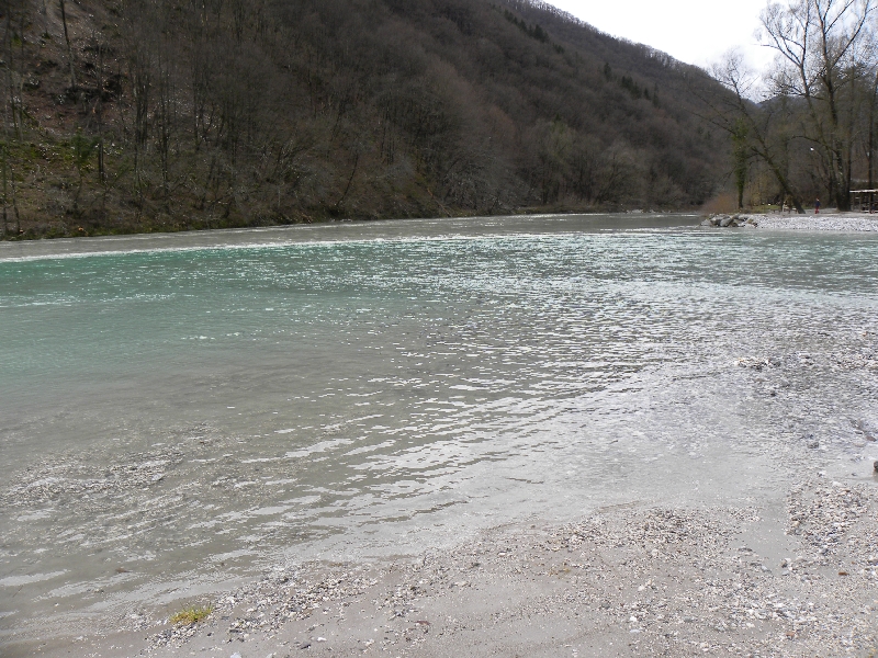
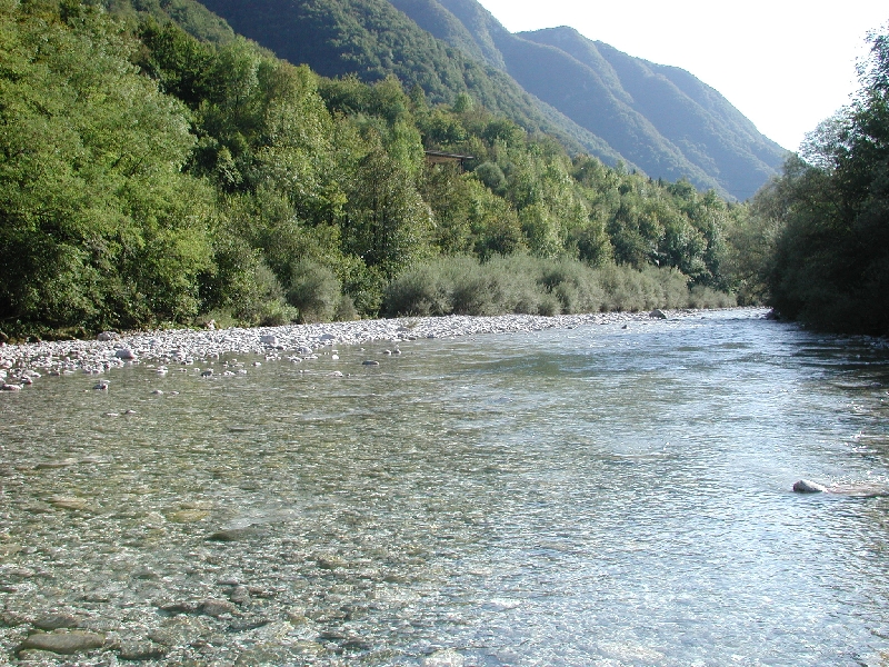
The Čezsoški Prodi and the Vrbulje
Here is the Soča riverbed in the territory of the Republic of Slovenija widest,
river water spreads 600 m wide, during floods.
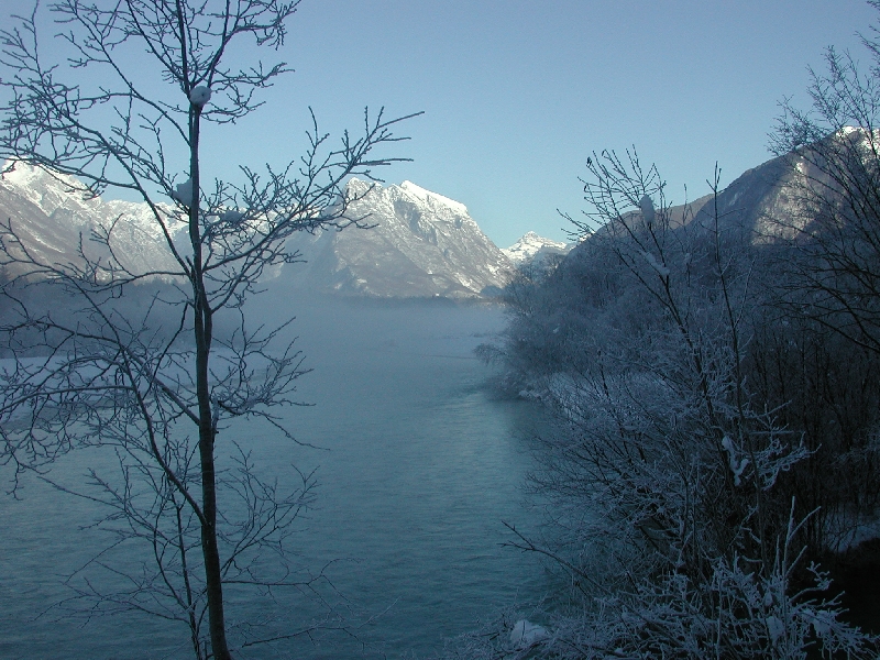
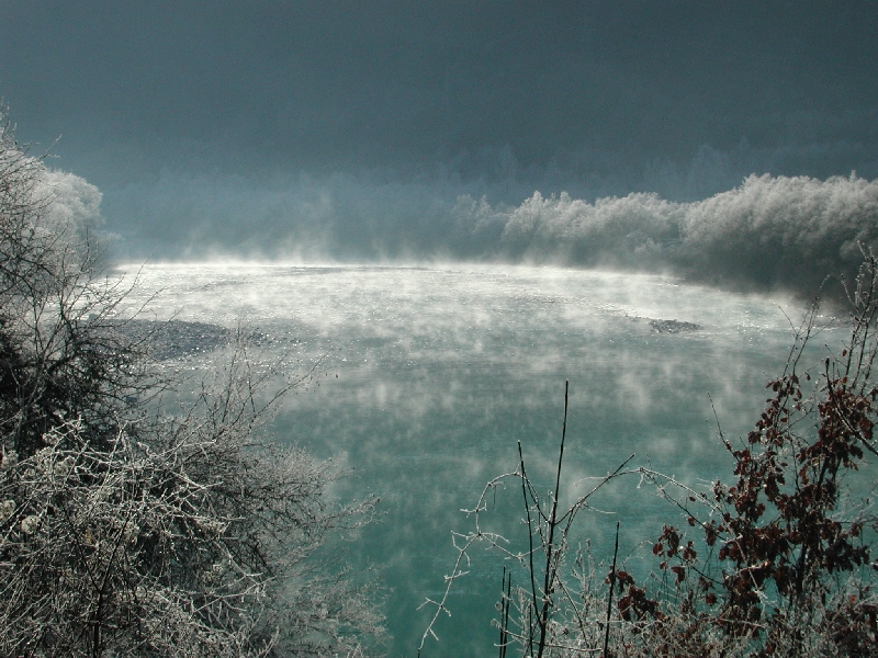
Winter Scene of the Soča River near the Čezsoča Vilage
Cold, frost, ... shadow four months long. In the background
rises Mt. Triglav (2864 m) above the Soča river.
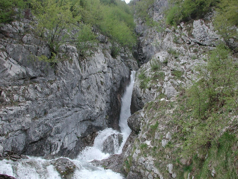
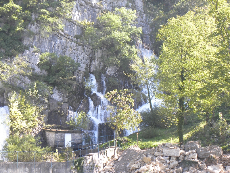
The Boka Waterfall
The Boka is the name of the cave, the spring, the waterfall, the gorge and the
torrent, right tributary of The Soča river. The Učja
The third spring branch of the Soča river is the
Učja river, which flows in deep gorge between Kanin
and Stol massifs. The first is on the left river side (as
water flows).
The Otona
The mightiest, triple pool in the Soča upper course. The name is plural,
(at Otonah, to Otonam). The Kobariška Soteska
In the Kobarid gorge, the Soča water level fluctuates by about 10 m.
The Kozjak
The Kozjak brook is left tributary of the Soča before
Kobarid. The brook falls in several waterfalls. The
mightiest waterfall is called Veliki Kozjak. The Soča near the Kamno
We find also here beautiful winter scenes.
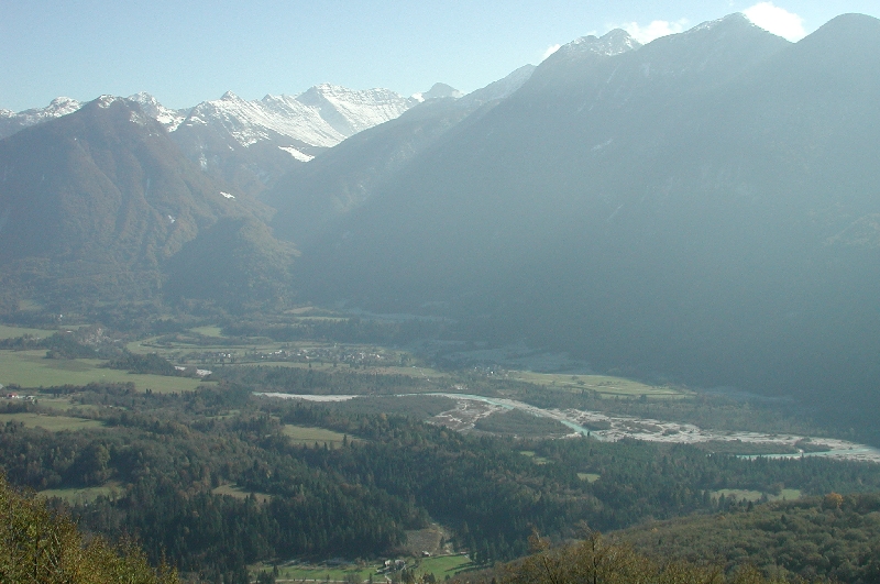
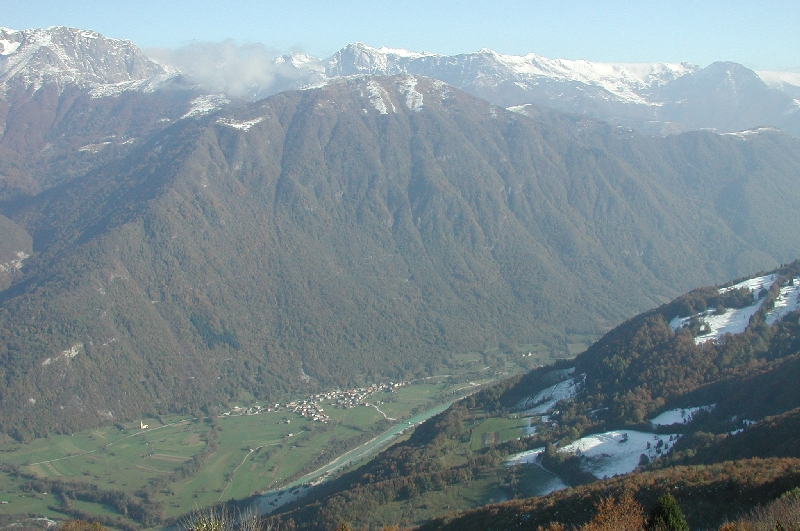
Valley of the Soča River near the Volarje
View from the Mt. Kolovrat (1243 m),
in the background (from left hand side to the right one)
valley of
Mrzlica
brook is the left spring branch of
Volarnk brook,
Rdeči rob (1913 m),
Mrzli vrh (1359 m) and Tolminsko-Bohinjski ridge.
The Tolminka River at Confluence with the
Azmica Brook
The Tolminka river is short left tributary of the Soča river flowing from high mountains.
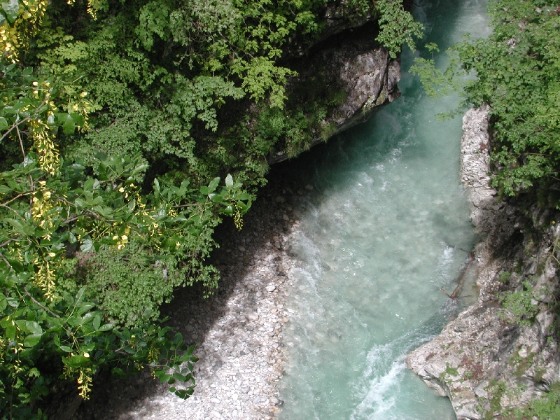
The Sotočje
Confluence (the Sotočje) of the Soča and Tolminka
rivers. The first one is turbid. Bright Tolminka flows
as wedge into the Soča.
The Divje Jezero and the Jezernica
The Divje jezero (Wild lake) is with 160 m the deepest
discovered karst spring in Slovenia. From it flows into the
Idrijca river short tributary. It is called the Jezernica (lake river) and it
is the shortest river in Slovenia, long is only 55 m.
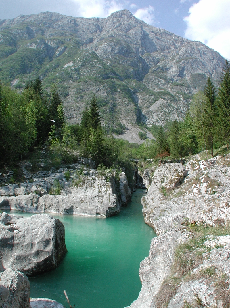
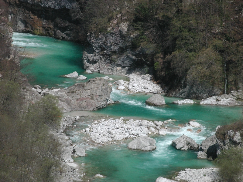
The Idrca
The Idrca (Idrijca) river is the strongest tributary of the
Soča in the middle course. The Idrca is characterized by
green water.
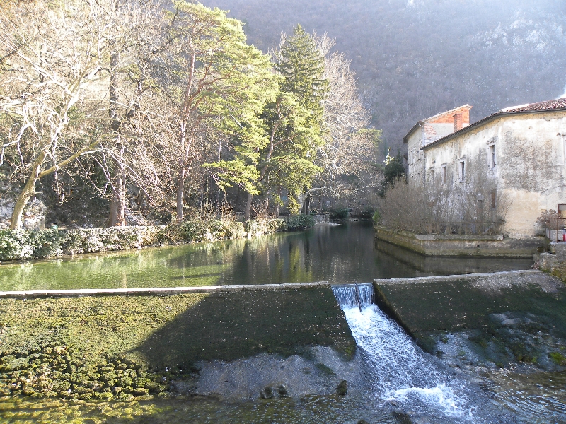
Confluence of the Soča and the Idrca Rivers
A rare view on the confluence of the Soča and Idrca rivers
in the Korita pod Miriščem below the Most na Soči when the
Mostarsko jezero = artificial lake is emptied.
Confluence of The Soča River
and the Belokačnica Brook
The Vogršček torrent flows into the Soča as
left tributary at an altitude of about 115 m.
The Soča Below the Ročinj
High, autumn the Soča under the conglomerate wall above the
source of Toplice (water comes up to 24 oC).
The Soča in the Plave
Floods almost poured over the bridge due to damming of the Soča at
Sovkan - Solkan. Deep Riverbed of the Soča
At the Sovkan (Solkan) the Soča leaves middle
course and slowly becoming a lowland river, but is still
wild.
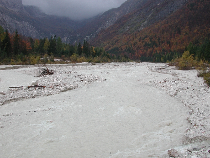
Wild, extremely high water Na Jezu
On the the channel was rolling around 2300 m3 of water, wood and debis per second
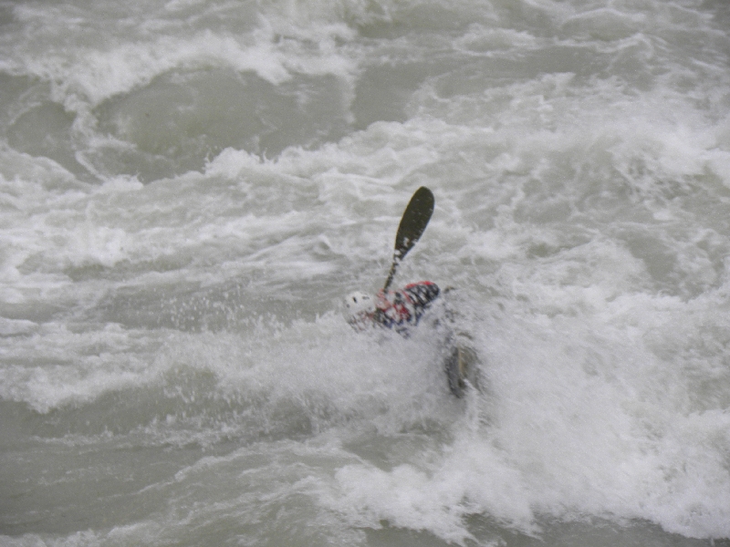
on Monday, 5th November, 2012 at 13 hours and 39 minutes, (in the picture). The Rapids Na Jezu
Below Sovkan - Solkan was built rowing course Na
Jezu in the Soča riverbed. At high water it
practiced by only skilled kayakers (on picture) and
canoeists on wild rivers.
The Soča Below Bridge at the Pevma
Near Pevma and Podgora lowest villages of Brda in Italy,
the Globoka struga Soče (deep channel) changes to normal depth.
Karst Inflow in the Lower Course
The arrows in the bottom right corner of the map of the
Soča drainage network show a karst water connection between
the stream of the Lokva in the Pojstojnska Basin and springs of the
Vipava river, on the other side of the Nanos karst massif.
The Lokva Brookbed Below the Jamski Grad
Ponor of the Lokva
The Vipava Spring Pod Skalco
The Bejla (Bela) Evorsion Channels Above the Vrhpolje
The Hubl (Hubelj) Spring
At high discharges falls water of karst springs Hubl in more
majestic waterfalls.
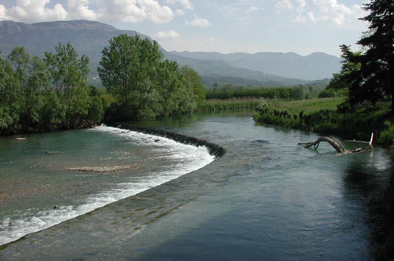
The Vipava River
The Vipava river near Kasule (Kasovlje). The Lijak Karst Spring
View from the Kras to karst spring the Lijak in
SouthWest foothills of the Trnovski gozd and
the bottom of the Vipava valley near the Renče.
The Nadiža River in the Deepest Gorge in Slovenija
Highly torrential the Nadiža river springs in two branches below
the Mt. Musc (1630 m). At Robič in the right angle
turns and cuts between the Mt. Mija (1237 m) and the Mt. Matajur (1642
m) in the deepest gorge of Slovenija, which exceeds 1000 m of
depth.
Confluence of the Nediža and the Ter Rivers
The Nediža flows from left into the Ter river, the biggest
river of the Beneška Slovenija, between the
Trivignan and Medejca.
Confluence of the Nediža and the Ter Rivers from the Air
Gravels of the Ter River
Torrential rivers deposited near the Medeja, a little below of
the confluence with the Nediža, a lot of gravel. The
riverbed of the Ter is in the lower course dry most of the year.
Confluence of the Soča and the Ter Rivers
The Ter flows from left into the Soča river near the Turjak.
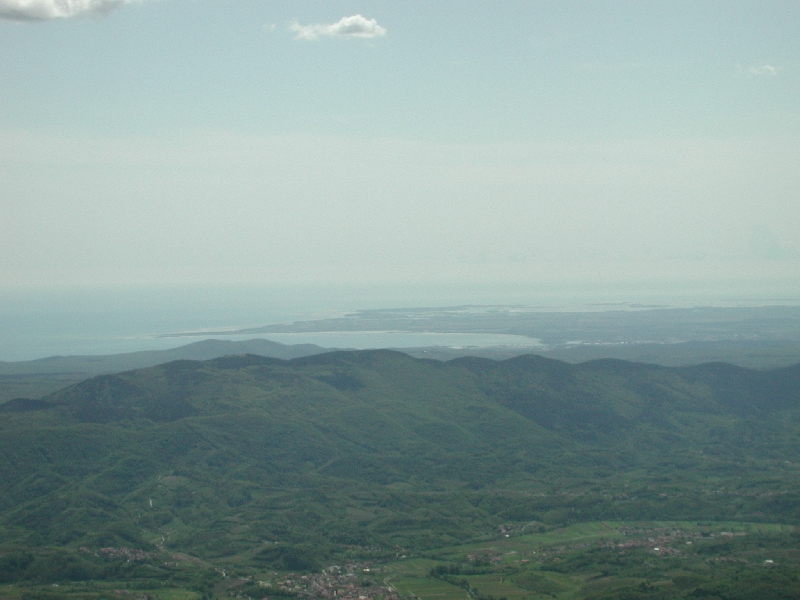
The Zdobje -Outflow of the Soča from Far Away
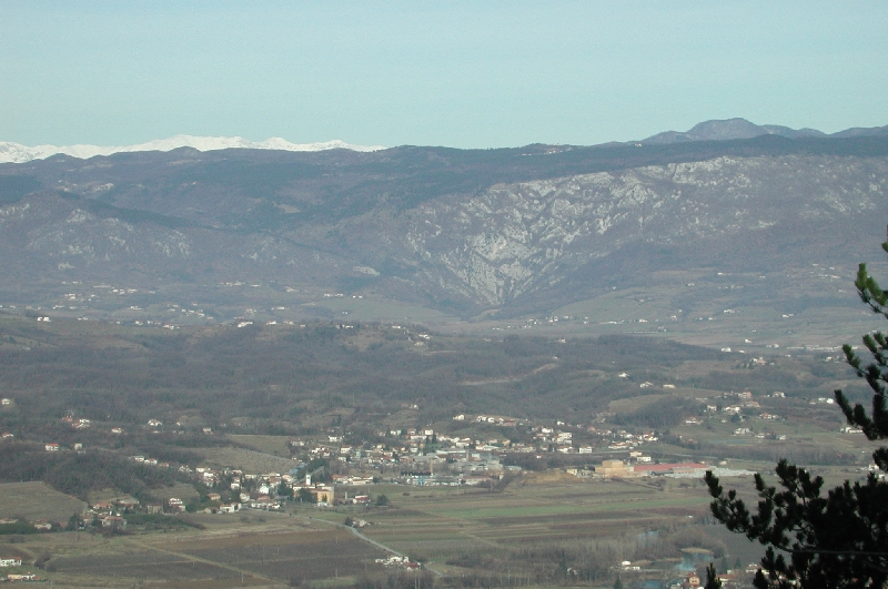
View on the Soča river mouth from the Trnovski gozd. In the foreground
is lower Vipava valley, between is the Kras and on the horizon in
gulf of the Tržič is stranded territory of the outflow.
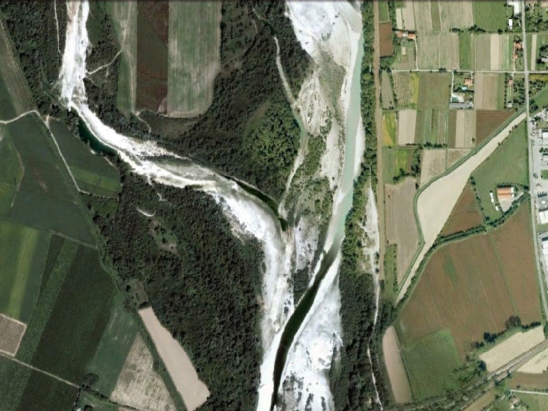
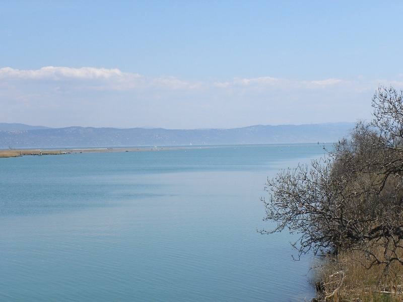
The Zdobje - Mouth of the Soča
at the Contact with the Adriatic Sea
Freshwater is floating above, heavy seawater in the bottom. So are distributed organisms.
Outflows are as much as tributaries and two into the Adriatic sea.
The Soča river flows in the sea on surface through Zdobje (strongly modified delta)
and through underground flow from karst springs
Timav (Il Timavo). Small river between karst springs and the sea is also
called Potok. Main outflows into the sea are marked on the map by two arrows.
The spings area was strongly modified, many natural
phenomena were destroyed during draining wetlands in the
sixties of the 20th century.
Water connection between the Soča river and the karst
springs has been confirmed with the same isotopes of oxygen
in the snow on the Mt. Kanin and in the karst water
in boreholes near Klariči and Brestovica, when they were looking for water supply
of the Kras region in seventies of the 20th century.
Water connection between the Soča river and the karst
springs has been confirmed with the same isotopes of oxygen
in the snow on the Mt. Kanin and in the karst water in
boreholes near Klariči and Brestovica, when they were
looking for water supply of the Kras region in seventies of
the 20th century.
Water connection between the Velka Voda - Reka river
and the karst springs has also been confirmed. When outflow
is low the Soča feeds Timav, a little is also water from the
Vipava river and from the Kras aquifer. The Velka voda -
Reka feeds Brojnice (submarine springs below Nabrežia -
Aurisina) together with water of the karst aquifer, at that
times. The Brojnice were captured for the Trst - Triest
water supply already in the 19th century. The
Velka voda - Reka river flows in the Timav only during major floods.
Sorry, haikus have not been translated in English, yet.

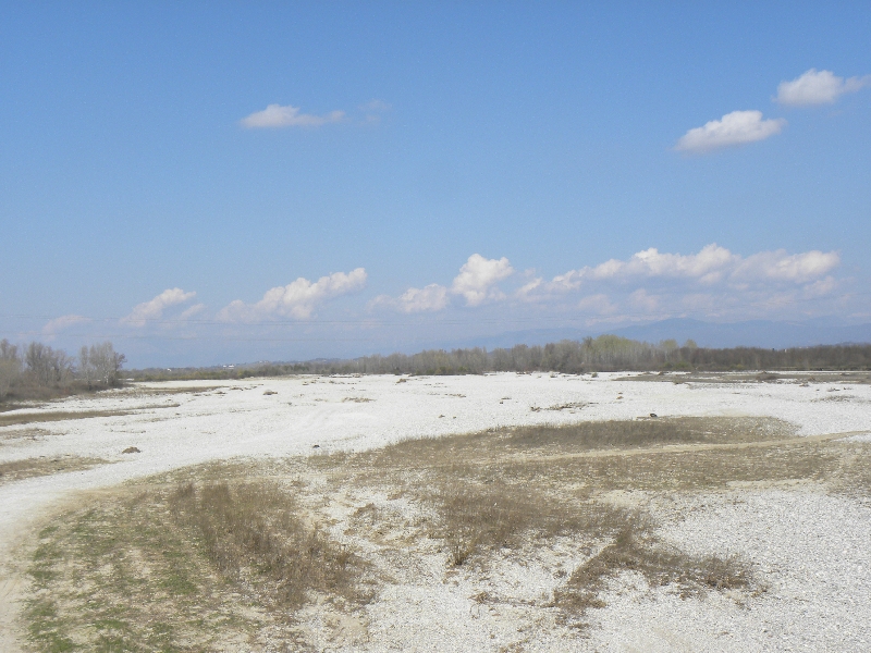
The pothole regularly dry up, especially in winters,
during severe droughts also in summers.
The Zmuklica or the Ghjekrlca Under Water

Photo in (c) Žiga Dolinšek, 2020.
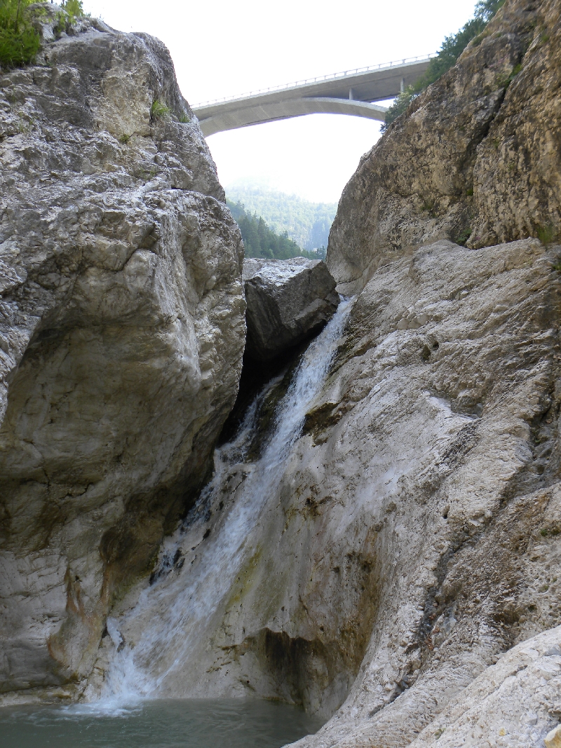
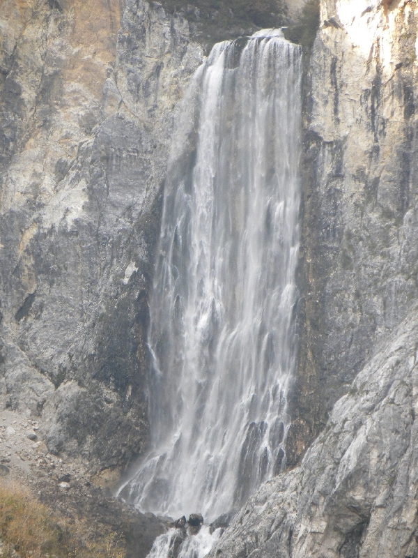
Waterfall is imposing, the mouth 30 m wide, below it falls
vertically 106 m deep (the highest waterfall in Posočje (the
Soča drainage area and in Slovenija), followed by about 25 m sloped waterfall
or steep rapids, then water flows over large boulders in the
low waterfalls and rapids in approximately 700 m long, about
50 m wide and 200 m deep gorge to the confluence with the
river. Interestingly, there is no large pools in the lower torrent bed of
the Boka.
Boka flow is highly variable, with the highest flow rates
over 100 m3/s. In such cases the water of the waterfall
disperses that man is wet to the skin on the road bridge
over the bed.
Oton is an old Slovenian word for pool.
It freezes in severe winters, which are quite rare.
The Azmica brook falling in many waterfalls on the other side of the Polog pasture and
flowing into the Tolminka river from left side over stone plates.
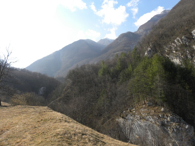
Drainage area of the river with about 600 km2
belongs to the Srednje
Posočje (the middle part of the Soča basin).
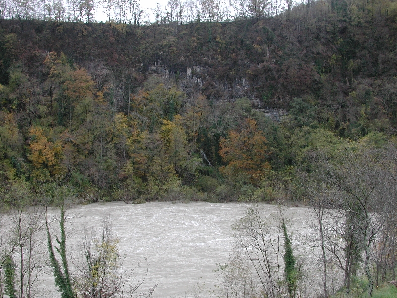
The Soča is turbid because of taking out debris. Waters do
not mix at least about 500 m, as far as one could see.
Water flows in the Soča around ten times a year, or
not at all, if it is a dry year. Most water just rushes out
of the Babja jama cave as the Belokačnica
brook. Flow combined with surface water of the
Vogršček is very rare, it occurs only after long,
heavy rains.
The Belokačnica brook flows into the Soča against
their stream. This phenomenon is called opposite confluence.
It is possible because of karst characters of the
Vogršček, the Belokačnica and the Soča
in this place. Therefore, the main river can not push a
tributary down with the main flow, as it is normal at
confluences.
The Toplice are usually submerged by the Ajbško jezero
artificial lake.
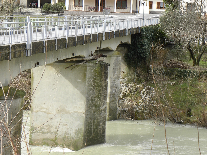
Remains of trees on the top of the right middle brace was
swept away by the flood on Monday, 5th November, 2012.
The bridge will be raised.
River is crossed by bridges. The first one in the picture
is railway bridge (with the largest stone arch on Earth with
104 m length) and the second one is on road to Brda.
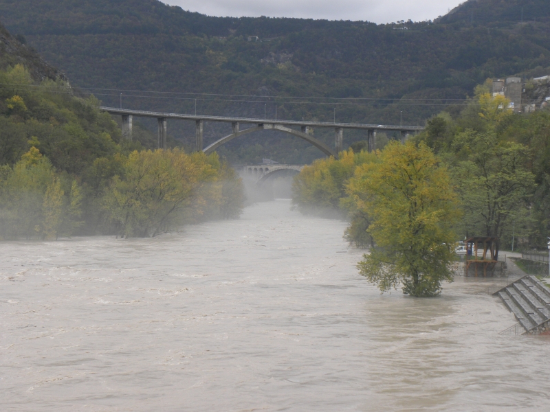
Peak was on the same day at 4 pm with the movement around 2400 m3s-1,
the water level was a little less than half a meter
higher than those in the picture.
15 more pictures of this extremely high water you can see
here .
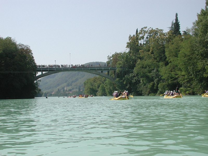
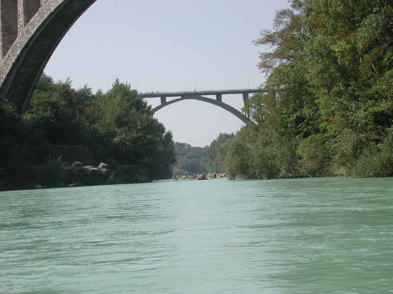
There are so many boats on the water each year
during the Soška regata in September.
The Lokva flows over flysch drainage basin and sinks at the contact
with limestones below the Jamski grad (cave castle).
Neighboring streams flowing into the Pivka river belongs to the
Black Sea basin, but the Lokva to the Adriatic.
It is left tributary of the Soča in the lower course near Sovodnje.
The Vipava has character of the lowland rivers in
entire course with strong karst influence.
In the background are the highest
peaks of the Julian Alps.
In the Beneška Slovenija becomes the Nediža.
Surprising thick pebbles (of up to 30 cm) in both riverbeds.
View from the Air to the Zdobje - Izliv Soče
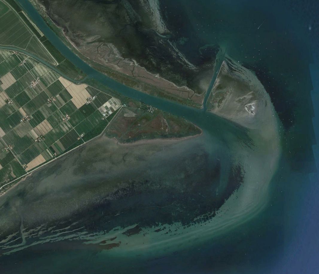
Interesting is the distribution of sediments in direction of sea current towards southwest.
Access to the Pages about The Soča
The page from 16th July, 2012 by
Daniel Rojšek, Danč.
Date of the last change 18th June, 2024.
Your comments are
welcome.
In your e-mail application . is to be changed to @ and
at the end of e-box delete <>.
This web intruders do not know, yet.
Number of visits since 16th July, 2012: